Distance from Mahwah to Clifton
Distance between Mahwah and Clifton is 26 kilometers (16 miles).
Driving distance from Mahwah to Clifton is 33 kilometers (21 miles).
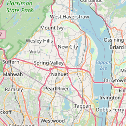
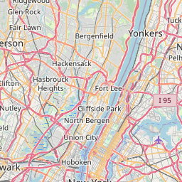
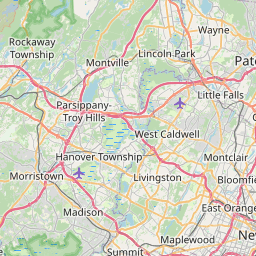
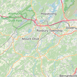
Distance Map Between Mahwah and Clifton
Mahwah, Trenton, United States ↔ Clifton, Trenton, United States = 16 miles = 26 km.

How far is it between Mahwah and Clifton
Mahwah is located in United States with (41.0887,-74.1438) coordinates and Clifton is located in United States with (40.8584,-74.1638) coordinates. The calculated flying distance from Mahwah to Clifton is equal to 16 miles which is equal to 26 km.
If you want to go by car, the driving distance between Mahwah and Clifton is 33.38 km. If you ride your car with an average speed of 112 kilometers/hour (70 miles/h), travel time will be 00 hours 17 minutes. Please check the avg. speed travel time table on the right for various options.
Difference between fly and go by a car is 7 km.
| City/Place | Latitude and Longitude | GPS Coordinates |
|---|---|---|
| Mahwah | 41.0887, -74.1438 | 41° 5´ 19.3560'' N 74° 8´ 37.5360'' W |
| Clifton | 40.8584, -74.1638 | 40° 51´ 30.3480'' N 74° 9´ 49.5360'' W |
Estimated Travel Time Between Mahwah and Clifton
| Average Speed | Travel Time |
|---|---|
| 30 mph (48 km/h) | 00 hours 41 minutes |
| 40 mph (64 km/h) | 00 hours 31 minutes |
| 50 mph (80 km/h) | 00 hours 25 minutes |
| 60 mph (97 km/h) | 00 hours 20 minutes |
| 70 mph (112 km/h) | 00 hours 17 minutes |
| 75 mph (120 km/h) | 00 hours 16 minutes |
Related Distances from Mahwah
| Cities | Distance |
|---|---|
| Mahwah to Jersey City | 55 km |
| Mahwah to Carteret | 69 km |
| Mahwah to Hoboken | 47 km |
| Mahwah to Hackensack | 27 km |
| Mahwah to Edison | 82 km |
Related Distances to Clifton
| Cities | Distance |
|---|---|
| Jersey City to Clifton | 24 km |
| North Bergen to Clifton | 22 km |
| Hackensack to Clifton | 19 km |
| Grand Junction to Clifton 2 | 9 km |
| Lyndhurst to Clifton | 9 km |