Distance from Makubetsu to Rumoi
Distance between Makubetsu and Rumoi is 160 kilometers (100 miles).
Driving distance from Makubetsu to Rumoi is 184 kilometers (115 miles).
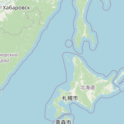
Distance Map Between Makubetsu and Rumoi
Makubetsu, Sapporo, Japan ↔ Rumoi, Sapporo, Japan = 100 miles = 160 km.

How far is it between Makubetsu and Rumoi
Makubetsu is located in Japan with (45.3714,141.8211) coordinates and Rumoi is located in Japan with (43.9344,141.6428) coordinates. The calculated flying distance from Makubetsu to Rumoi is equal to 100 miles which is equal to 160 km.
If you want to go by car, the driving distance between Makubetsu and Rumoi is 184.39 km. If you ride your car with an average speed of 112 kilometers/hour (70 miles/h), travel time will be 01 hours 38 minutes. Please check the avg. speed travel time table on the right for various options.
Difference between fly and go by a car is 24 km.
| City/Place | Latitude and Longitude | GPS Coordinates |
|---|---|---|
| Makubetsu | 45.3714, 141.8211 | 45° 22´ 17.0040'' N 141° 49´ 15.9960'' E |
| Rumoi | 43.9344, 141.6428 | 43° 56´ 3.9840'' N 141° 38´ 34.0080'' E |
Estimated Travel Time Between Makubetsu and Rumoi
| Average Speed | Travel Time |
|---|---|
| 30 mph (48 km/h) | 03 hours 50 minutes |
| 40 mph (64 km/h) | 02 hours 52 minutes |
| 50 mph (80 km/h) | 02 hours 18 minutes |
| 60 mph (97 km/h) | 01 hours 54 minutes |
| 70 mph (112 km/h) | 01 hours 38 minutes |
| 75 mph (120 km/h) | 01 hours 32 minutes |
Related Distances from Makubetsu
| Cities | Distance |
|---|---|
| Makubetsu to Muroran | 454 km |
| Makubetsu to Sunagawa | 261 km |
| Makubetsu to Wakkanai | 15 km |
| Makubetsu to Nayoro | 172 km |
| Makubetsu to Obihiro | 396 km |
Related Distances to Rumoi
| Cities | Distance |
|---|---|
| Otaru to Rumoi | 185 km |
| Iwamizawa to Rumoi | 116 km |
| Asahikawa to Rumoi | 90 km |
| Obihiro to Rumoi | 239 km |
| Nemuro to Rumoi | 442 km |