Distance from Malkapur to Yeola
Distance between Malkapur and Yeola is 202 kilometers (125 miles).
Driving distance from Malkapur to Yeola is 237 kilometers (148 miles).
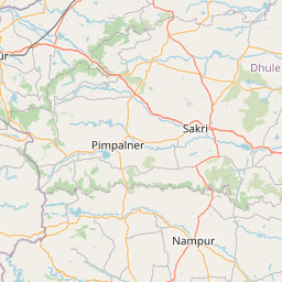
Distance Map Between Malkapur and Yeola
Malkapur, Mumbai, India ↔ Yeola, Mumbai, India = 125 miles = 202 km.


How far is it between Malkāpur and Yeola
Malkapur is located in India with (20.8856,76.2037) coordinates and Yeola is located in India with (20.0426,74.4899) coordinates. The calculated flying distance from Malkapur to Yeola is equal to 125 miles which is equal to 202 km.
If you want to go by car, the driving distance between Malkapur and Yeola is 237.47 km. If you ride your car with an average speed of 112 kilometers/hour (70 miles/h), travel time will be 02 hours 07 minutes. Please check the avg. speed travel time table on the right for various options.
Difference between fly and go by a car is 35 km.
| City/Place | Latitude and Longitude | GPS Coordinates |
|---|---|---|
| Malkapur | 20.8856, 76.2037 | 20° 53´ 8.1600'' N 76° 12´ 13.3560'' E |
| Yeola | 20.0426, 74.4899 | 20° 2´ 33.4320'' N 74° 29´ 23.6760'' E |
Estimated Travel Time Between Malkāpur and Yeola
| Average Speed | Travel Time |
|---|---|
| 30 mph (48 km/h) | 04 hours 56 minutes |
| 40 mph (64 km/h) | 03 hours 42 minutes |
| 50 mph (80 km/h) | 02 hours 58 minutes |
| 60 mph (97 km/h) | 02 hours 26 minutes |
| 70 mph (112 km/h) | 02 hours 07 minutes |
| 75 mph (120 km/h) | 01 hours 58 minutes |
Related Distances from Malkapur
| Cities | Distance |
|---|---|
| Malkapur to Malvan | 774 km |
| Malkapur to Mangrul Pir | 152 km |
| Malkapur to Manjlegaon | 264 km |
| Malkapur to Manmad | 224 km |
| Malkapur to Mehekar | 114 km |
| Malkapur to Moram | 454 km |
| Malkapur to Mudkhed | 293 km |
| Malkapur to Mukher | 358 km |
| Malkapur to Mul | 464 km |
| Malkapur to Murbad | 440 km |
Related Distances to Yeola
| Cities | Distance |
|---|---|
| Gangapur 2 to Yeola | 69 km |
| Lonavla to Yeola | 230 km |
| Pimpri to Yeola | 198 km |
| Pune to Yeola | 232 km |
| Nagpur to Yeola | 585 km |
| Malegaon to Yeola | 62 km |
| Chandrapur to Yeola | 637 km |
| Solapur to Yeola | 338 km |
| Navi Mumbai to Yeola | 247 km |
| Ahmadnagar to Yeola | 116 km |