Distance from Man to Touba
Distance between Man and Touba is 98 kilometers (61 miles).
Driving distance from Man to Touba is 110 kilometers (69 miles).
Distance Map Between Man and Touba
Man, Ivory Coast ↔ Touba, Ivory Coast = 61 miles = 98 km.

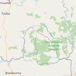
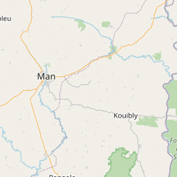
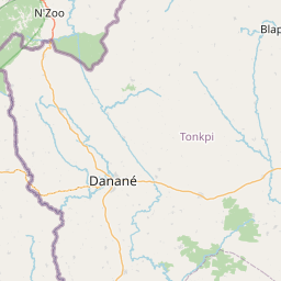


Leaflet | © OpenStreetMap
How far is it between Man and Touba
Man is located in Ivory Coast with (7.4125,-7.5538) coordinates and Touba is located in Ivory Coast with (8.2833,-7.6833) coordinates. The calculated flying distance from Man to Touba is equal to 61 miles which is equal to 98 km.
If you want to go by car, the driving distance between Man and Touba is 110.37 km. If you ride your car with an average speed of 112 kilometers/hour (70 miles/h), travel time will be 00 hours 59 minutes. Please check the avg. speed travel time table on the right for various options.
Difference between fly and go by a car is 12 km.
| City/Place | Latitude and Longitude | GPS Coordinates |
|---|---|---|
| Man | 7.4125, -7.5538 | 7° 24´ 45.0360'' N 7° 33´ 13.7880'' W |
| Touba | 8.2833, -7.6833 | 8° 16´ 59.9880'' N 7° 40´ 59.9880'' W |
Estimated Travel Time Between Man and Touba
| Average Speed | Travel Time |
|---|---|
| 30 mph (48 km/h) | 02 hours 17 minutes |
| 40 mph (64 km/h) | 01 hours 43 minutes |
| 50 mph (80 km/h) | 01 hours 22 minutes |
| 60 mph (97 km/h) | 01 hours 08 minutes |
| 70 mph (112 km/h) | 00 hours 59 minutes |
| 75 mph (120 km/h) | 00 hours 55 minutes |
Man, Ivory Coast
Related Distances from Man
| Cities | Distance |
|---|---|
| Man to Yamoussoukro | 329 km |
| Man to Odienne | 264 km |
| Man to San Pedro 2 | 404 km |
| Man to Touba 2 | 110 km |
| Man to Mankono | 200 km |
Touba, Ivory Coast
Related Distances to Touba
| Cities | Distance |
|---|---|
| Man to Touba 2 | 110 km |
| Abidjan to Touba 2 | 650 km |
| Odienne to Touba 2 | 155 km |
| Seguela to Touba 2 | 171 km |
| Bouake to Touba 2 | 366 km |