Distance from Mandalay to Banda
Distance between Mandalay and Banda is 1648 kilometers (1024 miles).
Driving distance from Mandalay to Banda is 2517 kilometers (1564 miles).
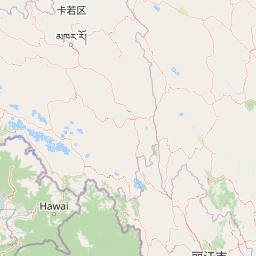
Distance Map Between Mandalay and Banda
Mandalay, Myanmar ↔ Banda, Lucknow, India = 1024 miles = 1648 km.


How far is it between Mandalay and Bānda
Mandalay is located in Myanmar with (21.9747,96.0836) coordinates and Banda is located in India with (25.4753,80.3358) coordinates. The calculated flying distance from Mandalay to Banda is equal to 1024 miles which is equal to 1648 km.
If you want to go by car, the driving distance between Mandalay and Banda is 2517.11 km. If you ride your car with an average speed of 112 kilometers/hour (70 miles/h), travel time will be 22 hours 28 minutes. Please check the avg. speed travel time table on the right for various options.
Difference between fly and go by a car is 869 km.
| City/Place | Latitude and Longitude | GPS Coordinates |
|---|---|---|
| Mandalay | 21.9747, 96.0836 | 21° 58´ 29.0280'' N 96° 5´ 0.9240'' E |
| Banda | 25.4753, 80.3358 | 25° 28´ 31.2240'' N 80° 20´ 8.8800'' E |
Estimated Travel Time Between Mandalay and Bānda
| Average Speed | Travel Time |
|---|---|
| 30 mph (48 km/h) | 52 hours 26 minutes |
| 40 mph (64 km/h) | 39 hours 19 minutes |
| 50 mph (80 km/h) | 31 hours 27 minutes |
| 60 mph (97 km/h) | 25 hours 56 minutes |
| 70 mph (112 km/h) | 22 hours 28 minutes |
| 75 mph (120 km/h) | 20 hours 58 minutes |
Related Distances from Mandalay
| Cities | Distance |
|---|---|
| Mandalay to Bangalore | 3902 km |
| Mandalay to Kolkata | 2046 km |
| Mandalay to Chennai | 3647 km |
| Mandalay to Lucknow | 2408 km |
| Mandalay to New Delhi | 2960 km |
Related Distances to Banda
| Cities | Distance |
|---|---|
| Yangon to Banda Aceh | 3868 km |
| Nay Pyi Taw to Banda Aceh | 4060 km |
| Yangon to Bandar Seri Begawan | 5767 km |
| Yangon to Banda | 3136 km |
| Nay Pyi Taw to Banda | 2760 km |