Distance from Mandalay to Ujhani
Distance between Mandalay and Ujhani is 1844 kilometers (1146 miles).
Driving distance from Mandalay to Ujhani is 2687 kilometers (1670 miles).
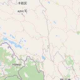
Distance Map Between Mandalay and Ujhani
Mandalay, Myanmar ↔ Ujhani, Lucknow, India = 1146 miles = 1844 km.


How far is it between Mandalay and Ujhāni
Mandalay is located in Myanmar with (21.9747,96.0836) coordinates and Ujhani is located in India with (28.002,79.0093) coordinates. The calculated flying distance from Mandalay to Ujhani is equal to 1146 miles which is equal to 1844 km.
If you want to go by car, the driving distance between Mandalay and Ujhani is 2687.02 km. If you ride your car with an average speed of 112 kilometers/hour (70 miles/h), travel time will be 23 hours 59 minutes. Please check the avg. speed travel time table on the right for various options.
Difference between fly and go by a car is 843 km.
| City/Place | Latitude and Longitude | GPS Coordinates |
|---|---|---|
| Mandalay | 21.9747, 96.0836 | 21° 58´ 29.0280'' N 96° 5´ 0.9240'' E |
| Ujhani | 28.002, 79.0093 | 28° 0´ 7.3080'' N 79° 0´ 33.3360'' E |
Estimated Travel Time Between Mandalay and Ujhāni
| Average Speed | Travel Time |
|---|---|
| 30 mph (48 km/h) | 55 hours 58 minutes |
| 40 mph (64 km/h) | 41 hours 59 minutes |
| 50 mph (80 km/h) | 33 hours 35 minutes |
| 60 mph (97 km/h) | 27 hours 42 minutes |
| 70 mph (112 km/h) | 23 hours 59 minutes |
| 75 mph (120 km/h) | 22 hours 23 minutes |
Related Distances from Mandalay
| Cities | Distance |
|---|---|
| Mandalay to Bangalore | 3902 km |
| Mandalay to Kolkata | 2046 km |
| Mandalay to Chennai | 3647 km |
| Mandalay to Lucknow | 2408 km |
| Mandalay to New Delhi | 2960 km |
Related Distances to Ujhani
| Cities | Distance |
|---|---|
| Yangon to Ujhani | 3277 km |
| Nay Pyi Taw to Ujhani | 2919 km |
| Mandalay to Ujhani | 2687 km |