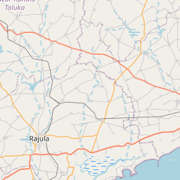
Distance from Mangrol to Rajula
Distance between Mangrol and Rajula is 138 kilometers (86 miles).
Driving distance from Mangrol to Rajula is 179 kilometers (111 miles).
Distance Map Between Mangrol and Rajula
Mangrol, Ghandinagar, India ↔ Rajula, Ghandinagar, India = 86 miles = 138 km.


How far is it between Māngrol and Rājula
Mangrol is located in India with (21.1227,70.1148) coordinates and Rajula is located in India with (21.0385,71.4435) coordinates. The calculated flying distance from Mangrol to Rajula is equal to 86 miles which is equal to 138 km.
If you want to go by car, the driving distance between Mangrol and Rajula is 178.58 km. If you ride your car with an average speed of 112 kilometers/hour (70 miles/h), travel time will be 01 hours 35 minutes. Please check the avg. speed travel time table on the right for various options.
Difference between fly and go by a car is 41 km.
| City/Place | Latitude and Longitude | GPS Coordinates |
|---|---|---|
| Mangrol | 21.1227, 70.1148 | 21° 7´ 21.6480'' N 70° 6´ 53.4240'' E |
| Rajula | 21.0385, 71.4435 | 21° 2´ 18.7440'' N 71° 26´ 36.4200'' E |
Estimated Travel Time Between Māngrol and Rājula
| Average Speed | Travel Time |
|---|---|
| 30 mph (48 km/h) | 03 hours 43 minutes |
| 40 mph (64 km/h) | 02 hours 47 minutes |
| 50 mph (80 km/h) | 02 hours 13 minutes |
| 60 mph (97 km/h) | 01 hours 50 minutes |
| 70 mph (112 km/h) | 01 hours 35 minutes |
| 75 mph (120 km/h) | 01 hours 29 minutes |
Related Distances from Mangrol
| Cities | Distance |
|---|---|
| Mangrol to Surat | 638 km |
| Mangrol to Porbandar | 82 km |
| Mangrol to Veraval | 44 km |
| Mangrol to Rajkot | 164 km |
| Mangrol to Una | 125 km |
Related Distances to Rajula
| Cities | Distance |
|---|---|
| Kodinar to Rajula | 92 km |
| Ahmedabad to Rajula | 301 km |
| Amreli to Rajula | 71 km |
| Jamnagar to Rajula | 257 km |
| Rajkot to Rajula | 177 km |