Distance from Manitowoc to De Pere
Distance between Manitowoc and De Pere is 51 kilometers (32 miles).
Driving distance from Manitowoc to De Pere is 64 kilometers (40 miles).
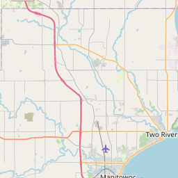
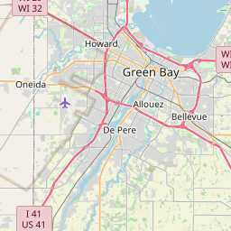
Distance Map Between Manitowoc and De Pere
Manitowoc, Madison, United States ↔ De Pere, Madison, United States = 32 miles = 51 km.


How far is it between Manitowoc and De Pere
Manitowoc is located in United States with (44.0886,-87.6576) coordinates and De Pere is located in United States with (44.4489,-88.0604) coordinates. The calculated flying distance from Manitowoc to De Pere is equal to 32 miles which is equal to 51 km.
If you want to go by car, the driving distance between Manitowoc and De Pere is 64.47 km. If you ride your car with an average speed of 112 kilometers/hour (70 miles/h), travel time will be 00 hours 34 minutes. Please check the avg. speed travel time table on the right for various options.
Difference between fly and go by a car is 13 km.
| City/Place | Latitude and Longitude | GPS Coordinates |
|---|---|---|
| Manitowoc | 44.0886, -87.6576 | 44° 5´ 18.9960'' N 87° 39´ 27.2880'' W |
| De Pere | 44.4489, -88.0604 | 44° 26´ 55.9680'' N 88° 3´ 37.3680'' W |
Estimated Travel Time Between Manitowoc and De Pere
| Average Speed | Travel Time |
|---|---|
| 30 mph (48 km/h) | 01 hours 20 minutes |
| 40 mph (64 km/h) | 01 hours 00 minutes |
| 50 mph (80 km/h) | 00 hours 48 minutes |
| 60 mph (97 km/h) | 00 hours 39 minutes |
| 70 mph (112 km/h) | 00 hours 34 minutes |
| 75 mph (120 km/h) | 00 hours 32 minutes |
Related Distances from Manitowoc
| Cities | Distance |
|---|---|
| Manitowoc to Green Bay | 69 km |
| Manitowoc to Fond Du Lac | 99 km |
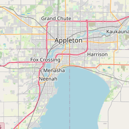
| Manitowoc to Appleton | 73 km |
| Manitowoc to La Crosse | 376 km |
| Manitowoc to De Pere | 64 km |
Related Distances to De Pere
| Cities | Distance |
|---|---|
| Milwaukee to De Pere | 186 km |
| Wisconsin Rapids to De Pere | 172 km |
| Green Bay to De Pere | 10 km |
| Manitowoc to De Pere | 64 km |
| Sheboygan to De Pere | 102 km |