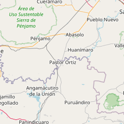
Distance from Marfil to Penjamo
Distance between Marfil and Penjamo is 77 kilometers (48 miles).
Driving distance from Marfil to Penjamo is 102 kilometers (63 miles).
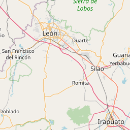
Distance Map Between Marfil and Penjamo
Marfil, Guanajuato, Mexico ↔ Penjamo, Guanajuato, Mexico = 48 miles = 77 km.


How far is it between Marfil and Pénjamo
Marfil is located in Mexico with (20.9988,-101.2875) coordinates and Penjamo is located in Mexico with (20.4322,-101.7213) coordinates. The calculated flying distance from Marfil to Penjamo is equal to 48 miles which is equal to 77 km.
If you want to go by car, the driving distance between Marfil and Penjamo is 101.89 km. If you ride your car with an average speed of 112 kilometers/hour (70 miles/h), travel time will be 00 hours 54 minutes. Please check the avg. speed travel time table on the right for various options.
Difference between fly and go by a car is 25 km.
| City/Place | Latitude and Longitude | GPS Coordinates |
|---|---|---|
| Marfil | 20.9988, -101.2875 | 20° 59´ 55.8240'' N 101° 17´ 15.0360'' W |
| Penjamo | 20.4322, -101.7213 | 20° 25´ 55.9920'' N 101° 43´ 16.6440'' W |
Estimated Travel Time Between Marfil and Pénjamo
| Average Speed | Travel Time |
|---|---|
| 30 mph (48 km/h) | 02 hours 07 minutes |
| 40 mph (64 km/h) | 01 hours 35 minutes |
| 50 mph (80 km/h) | 01 hours 16 minutes |
| 60 mph (97 km/h) | 01 hours 03 minutes |
| 70 mph (112 km/h) | 00 hours 54 minutes |
| 75 mph (120 km/h) | 00 hours 50 minutes |
Related Distances from Marfil
| Cities | Distance |
|---|---|
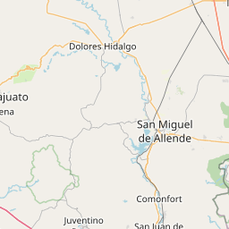
| Marfil to San Miguel De Allende | 72 km |
| Marfil to Moroleon | 127 km |
| Marfil to Silao | 18 km |
| Marfil to Salamanca 3 | 73 km |
| Marfil to Valle De Santiago | 81 km |
Related Distances to Penjamo
| Cities | Distance |
|---|---|
| Leon to Penjamo | 132 km |
| Acambaro to Penjamo | 215 km |
| Irapuato to Penjamo | 52 km |
| Celaya to Penjamo | 113 km |
| Apaseo El Grande to Penjamo | 124 km |