Distance from Marion to Xenia
Distance between Marion and Xenia is 121 kilometers (75 miles).
Driving distance from Marion to Xenia is 135 kilometers (84 miles).
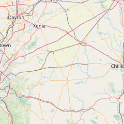
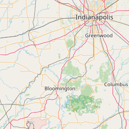
Distance Map Between Marion and Xenia
Marion, Columbus, United States ↔ Xenia, Columbus, United States = 75 miles = 121 km.


How far is it between Marion and Xenia
Marion is located in United States with (40.5887,-83.1285) coordinates and Xenia is located in United States with (39.6848,-83.9297) coordinates. The calculated flying distance from Marion to Xenia is equal to 75 miles which is equal to 121 km.
If you want to go by car, the driving distance between Marion and Xenia is 134.94 km. If you ride your car with an average speed of 112 kilometers/hour (70 miles/h), travel time will be 01 hours 12 minutes. Please check the avg. speed travel time table on the right for various options.
Difference between fly and go by a car is 14 km.
| City/Place | Latitude and Longitude | GPS Coordinates |
|---|---|---|
| Marion | 40.5887, -83.1285 | 40° 35´ 19.2120'' N 83° 7´ 42.6720'' W |
| Xenia | 39.6848, -83.9297 | 39° 41´ 5.2080'' N 83° 55´ 46.7400'' W |
Estimated Travel Time Between Marion and Xenia
| Average Speed | Travel Time |
|---|---|
| 30 mph (48 km/h) | 02 hours 48 minutes |
| 40 mph (64 km/h) | 02 hours 06 minutes |
| 50 mph (80 km/h) | 01 hours 41 minutes |
| 60 mph (97 km/h) | 01 hours 23 minutes |
| 70 mph (112 km/h) | 01 hours 12 minutes |
| 75 mph (120 km/h) | 01 hours 07 minutes |
Related Distances from Marion
| Cities | Distance |
|---|---|
| Marion to Delaware | 34 km |
| Marion to Cleveland | 198 km |
| Marion to Lima 2 | 89 km |
| Marion to Mansfield 3 | 71 km |
| Marion to Canton 2 | 173 km |
Related Distances to Xenia
| Cities | Distance |
|---|---|
| Cleveland to Xenia | 330 km |
| Troy 3 to Xenia | 60 km |
| Chillicothe to Xenia | 99 km |
| Lima 2 to Xenia | 149 km |
| Wooster to Xenia | 256 km |