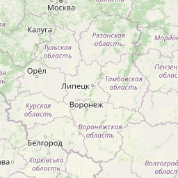
Distance from Mariupol to Shuya
Distance between Mariupol and Shuya is 1116 kilometers (693 miles).
Distance Map Between Mariupol and Shuya
Mariupol, Donetsk, Ukraine ↔ Shuya, Ivanovo, Russia = 693 miles = 1116 km.


Leaflet | © OpenStreetMap
How far is it between Mariupol and Shuya
Mariupol is located in Ukraine with (47.0951,37.5413) coordinates and Shuya is located in Russia with (56.8487,41.3883) coordinates. The calculated flying distance from Mariupol to Shuya is equal to 693 miles which is equal to 1116 km.
| City/Place | Latitude and Longitude | GPS Coordinates |
|---|---|---|
| Mariupol | 47.0951, 37.5413 | 47° 5´ 42.5040'' N 37° 32´ 28.7160'' E |
| Shuya | 56.8487, 41.3883 | 56° 50´ 55.1400'' N 41° 23´ 17.9880'' E |
Mariupol, Donetsk, Ukraine
Related Distances from Mariupol
| Cities | Distance |
|---|---|
| Mariupol to Glazov | 2101 km |
| Mariupol to Moscow | 1247 km |
| Mariupol to Orenburg | 1841 km |
| Mariupol to Vladimir | 1386 km |
| Mariupol to Samara | 1459 km |
Shuya, Ivanovo, Russia
Related Distances to Shuya
| Cities | Distance |
|---|---|
| Kiev to Shuya | 1173 km |
| Luhansk to Shuya | 1241 km |
| Kryvyi Rih to Shuya | 1424 km |
| Odessa to Shuya | 1652 km |
| Zaporizhzhya to Shuya | 1339 km |