Distance from Mawlamyine to Mettur
Distance between Mawlamyine and Mettur is 2200 kilometers (1367 miles).
Driving distance from Mawlamyine to Mettur is 4709 kilometers (2926 miles).
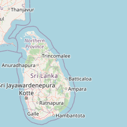
Distance Map Between Mawlamyine and Mettur
Mawlamyine, Myanmar ↔ Mettur, Chennai, India = 1367 miles = 2200 km.


How far is it between Mawlamyine and Mettur
Mawlamyine is located in Myanmar with (16.4905,97.6283) coordinates and Mettur is located in India with (11.788,77.8008) coordinates. The calculated flying distance from Mawlamyine to Mettur is equal to 1367 miles which is equal to 2200 km.
If you want to go by car, the driving distance between Mawlamyine and Mettur is 4708.8 km. If you ride your car with an average speed of 112 kilometers/hour (70 miles/h), travel time will be 42 hours 02 minutes. Please check the avg. speed travel time table on the right for various options.
Difference between fly and go by a car is 2509 km.
| City/Place | Latitude and Longitude | GPS Coordinates |
|---|---|---|
| Mawlamyine | 16.4905, 97.6283 | 16° 29´ 25.8360'' N 97° 37´ 41.7000'' E |
| Mettur | 11.788, 77.8008 | 11° 47´ 16.6560'' N 77° 48´ 2.8800'' E |
Estimated Travel Time Between Mawlamyine and Mettur
| Average Speed | Travel Time |
|---|---|
| 30 mph (48 km/h) | 98 hours 06 minutes |
| 40 mph (64 km/h) | 73 hours 34 minutes |
| 50 mph (80 km/h) | 58 hours 51 minutes |
| 60 mph (97 km/h) | 48 hours 32 minutes |
| 70 mph (112 km/h) | 42 hours 02 minutes |
| 75 mph (120 km/h) | 39 hours 14 minutes |
Related Distances from Mawlamyine
| Cities | Distance |
|---|---|
| Mawlamyine to Chennai | 4409 km |
| Mawlamyine to Hyderabad | 4143 km |
| Mawlamyine to Puducherry | 4566 km |
| Mawlamyine to Vellore | 4481 km |
| Mawlamyine to Krishnagiri | 4602 km |
Related Distances to Mettur
| Cities | Distance |
|---|---|
| Mawlamyine to Mettur | 4709 km |
| Bago to Mettur | 4520 km |
| Yangon to Mettur | 4590 km |
| Nay Pyi Taw to Mettur | 4231 km |
| Mandalay to Mettur | 3964 km |