Distance from Milledgeville to Macon
Distance between Milledgeville and Macon is 46 kilometers (28 miles).
Driving distance from Milledgeville to Macon is 49 kilometers (30 miles).
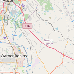
Distance Map Between Milledgeville and Macon
Milledgeville, Atlanta, United States ↔ Macon, Atlanta, United States = 28 miles = 46 km.


How far is it between Milledgeville and Macon
Milledgeville is located in United States with (33.0801,-83.2321) coordinates and Macon is located in United States with (32.8407,-83.6324) coordinates. The calculated flying distance from Milledgeville to Macon is equal to 28 miles which is equal to 46 km.
If you want to go by car, the driving distance between Milledgeville and Macon is 48.56 km. If you ride your car with an average speed of 112 kilometers/hour (70 miles/h), travel time will be 00 hours 26 minutes. Please check the avg. speed travel time table on the right for various options.
Difference between fly and go by a car is 3 km.
| City/Place | Latitude and Longitude | GPS Coordinates |
|---|---|---|
| Milledgeville | 33.0801, -83.2321 | 33° 4´ 48.5040'' N 83° 13´ 55.5600'' W |
| Macon | 32.8407, -83.6324 | 32° 50´ 26.4840'' N 83° 37´ 56.6400'' W |
Estimated Travel Time Between Milledgeville and Macon
| Average Speed | Travel Time |
|---|---|
| 30 mph (48 km/h) | 01 hours 00 minutes |
| 40 mph (64 km/h) | 00 hours 45 minutes |
| 50 mph (80 km/h) | 00 hours 36 minutes |
| 60 mph (97 km/h) | 00 hours 30 minutes |
| 70 mph (112 km/h) | 00 hours 26 minutes |
| 75 mph (120 km/h) | 00 hours 24 minutes |
Related Distances from Milledgeville
| Cities | Distance |
|---|---|
| Milledgeville to Acworth | 210 km |
| Milledgeville to Albany 2 | 218 km |
| Milledgeville to Alpharetta | 194 km |
| Milledgeville to Americus | 168 km |
| Milledgeville to Athens 2 | 119 km |
| Milledgeville to Augusta | 151 km |
| Milledgeville to Brunswick 3 | 363 km |
| Milledgeville to Calhoun | 269 km |
| Milledgeville to Canton 3 | 223 km |
| Milledgeville to Carrollton 2 | 237 km |
Related Distances to Macon
| Cities | Distance |
|---|---|
| Mcdonough to Macon | 91 km |
| Statesboro to Macon | 204 km |
| Johns Creek to Macon | 172 km |
| Thomasville 2 to Macon | 243 km |
| Peachtree City to Macon | 125 km |
| Warner Robins to Macon | 29 km |
| Woodstock 3 to Macon | 183 km |
| Milton 2 to Macon | 185 km |
| North Atlanta to Macon | 152 km |
| St Marys to Macon | 419 km |