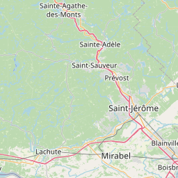
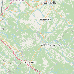
Distance from Mirabel to Magog
Distance between Mirabel and Magog is 157 kilometers (97 miles).
Driving distance from Mirabel to Magog is 180 kilometers (112 miles).
Distance Map Between Mirabel and Magog
Mirabel, Quebec, Canada ↔ Magog, Quebec, Canada = 97 miles = 157 km.

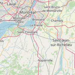
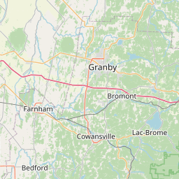
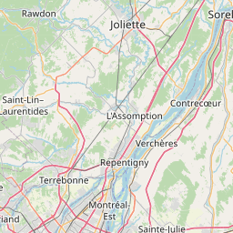
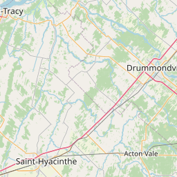

How far is it between Mirabel and Magog
Mirabel is located in Canada with (45.6501,-74.0825) coordinates and Magog is located in Canada with (45.2668,-72.1491) coordinates. The calculated flying distance from Mirabel to Magog is equal to 97 miles which is equal to 157 km.
If you want to go by car, the driving distance between Mirabel and Magog is 179.57 km. If you ride your car with an average speed of 112 kilometers/hour (70 miles/h), travel time will be 01 hours 36 minutes. Please check the avg. speed travel time table on the right for various options.
Difference between fly and go by a car is 23 km.
| City/Place | Latitude and Longitude | GPS Coordinates |
|---|---|---|
| Mirabel | 45.6501, -74.0825 | 45° 39´ 0.2880'' N 74° 4´ 57.0360'' W |
| Magog | 45.2668, -72.1491 | 45° 16´ 0.4080'' N 72° 8´ 56.7240'' W |
Estimated Travel Time Between Mirabel and Magog
| Average Speed | Travel Time |
|---|---|
| 30 mph (48 km/h) | 03 hours 44 minutes |
| 40 mph (64 km/h) | 02 hours 48 minutes |
| 50 mph (80 km/h) | 02 hours 14 minutes |
| 60 mph (97 km/h) | 01 hours 51 minutes |
| 70 mph (112 km/h) | 01 hours 36 minutes |
| 75 mph (120 km/h) | 01 hours 29 minutes |
Related Distances from Mirabel
| Cities | Distance |
|---|---|
| Mirabel to Gatineau | 149 km |
| Mirabel to Blainville | 23 km |
| Mirabel to Laval | 42 km |
| Mirabel to Brossard | 68 km |
| Mirabel to Boisbriand | 28 km |
Related Distances to Magog
| Cities | Distance |
|---|---|
| Montreal to Magog | 131 km |
| Sherbrooke to Magog | 36 km |
| Trois Rivieres to Magog | 179 km |
| Sorel Tracy to Magog | 156 km |
| Saint Hyacinthe to Magog | 102 km |