Distance from Misratah to Sirte
Distance between Misratah and Sirte is 192 kilometers (119 miles).
Driving distance from Misratah to Sirte is 269 kilometers (167 miles).
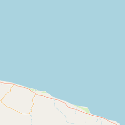
Distance Map Between Misratah and Sirte
Misratah, Libya ↔ Sirte, Libya = 119 miles = 192 km.


How far is it between Mişrātah and Sirte
Misratah is located in Libya with (32.3754,15.0925) coordinates and Sirte is located in Libya with (31.2089,16.5887) coordinates. The calculated flying distance from Misratah to Sirte is equal to 119 miles which is equal to 192 km.
If you want to go by car, the driving distance between Misratah and Sirte is 268.61 km. If you ride your car with an average speed of 112 kilometers/hour (70 miles/h), travel time will be 02 hours 23 minutes. Please check the avg. speed travel time table on the right for various options.
Difference between fly and go by a car is 77 km.
| City/Place | Latitude and Longitude | GPS Coordinates |
|---|---|---|
| Misratah | 32.3754, 15.0925 | 32° 22´ 31.2600'' N 15° 5´ 33.1440'' E |
| Sirte | 31.2089, 16.5887 | 31° 12´ 32.1120'' N 16° 35´ 19.1760'' E |
Estimated Travel Time Between Mişrātah and Sirte
| Average Speed | Travel Time |
|---|---|
| 30 mph (48 km/h) | 05 hours 35 minutes |
| 40 mph (64 km/h) | 04 hours 11 minutes |
| 50 mph (80 km/h) | 03 hours 21 minutes |
| 60 mph (97 km/h) | 02 hours 46 minutes |
| 70 mph (112 km/h) | 02 hours 23 minutes |
| 75 mph (120 km/h) | 02 hours 14 minutes |
Related Distances from Misratah
| Cities | Distance |
|---|---|
| Misratah to Benghazi | 833 km |
| Misratah to Tripoli | 206 km |
| Misratah to Suluq | 782 km |
| Misratah to Sabha | 665 km |
| Misratah to Zuwarah | 319 km |
Related Distances to Sirte
| Cities | Distance |
|---|---|
| Sabha to Sirte | 623 km |
| Awbari to Sirte | 815 km |
| Al Khums to Sirte | 339 km |
| Ghat to Sirte | 1185 km |
| Hun to Sirte | 276 km |