Distance from Moers to Troisdorf
Distance between Moers and Troisdorf is 80 kilometers (50 miles).
Driving distance from Moers to Troisdorf is 105 kilometers (65 miles).
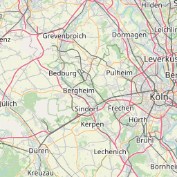
Distance Map Between Moers and Troisdorf
Moers, Dusseldorf, Germany ↔ Troisdorf, Dusseldorf, Germany = 50 miles = 80 km.


How far is it between Moers and Troisdorf
Moers is located in Germany with (51.4534,6.6326) coordinates and Troisdorf is located in Germany with (50.809,7.1497) coordinates. The calculated flying distance from Moers to Troisdorf is equal to 50 miles which is equal to 80 km.
If you want to go by car, the driving distance between Moers and Troisdorf is 104.83 km. If you ride your car with an average speed of 112 kilometers/hour (70 miles/h), travel time will be 00 hours 56 minutes. Please check the avg. speed travel time table on the right for various options.
Difference between fly and go by a car is 25 km.
| City/Place | Latitude and Longitude | GPS Coordinates |
|---|---|---|
| Moers | 51.4534, 6.6326 | 51° 27´ 12.3120'' N 6° 37´ 57.3600'' E |
| Troisdorf | 50.809, 7.1497 | 50° 48´ 32.4360'' N 7° 8´ 58.8480'' E |
Estimated Travel Time Between Moers and Troisdorf
| Average Speed | Travel Time |
|---|---|
| 30 mph (48 km/h) | 02 hours 11 minutes |
| 40 mph (64 km/h) | 01 hours 38 minutes |
| 50 mph (80 km/h) | 01 hours 18 minutes |
| 60 mph (97 km/h) | 01 hours 04 minutes |
| 70 mph (112 km/h) | 00 hours 56 minutes |
| 75 mph (120 km/h) | 00 hours 52 minutes |
Related Distances from Moers
| Cities | Distance |
|---|---|
| Moers to Viersen | 41 km |
| Moers to Monchengladbach | 44 km |
| Moers to Wuppertal | 67 km |
| Moers to Muenster | 109 km |
| Moers to Rietberg | 153 km |
Related Distances to Troisdorf
| Cities | Distance |
|---|---|
| Bonn to Troisdorf | 13 km |
| Bergheim to Troisdorf | 56 km |
| Koeln to Troisdorf | 25 km |
| Essen to Troisdorf | 87 km |
| Frechen to Troisdorf | 38 km |