Distance from Mogadishu to Uvira
Distance between Mogadishu and Uvira is 1900 kilometers (1180 miles).
Driving distance from Mogadishu to Uvira is 2630 kilometers (1634 miles).
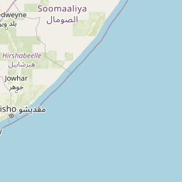
Distance Map Between Mogadishu and Uvira
Mogadishu, Somalia ↔ Uvira, Bukavu, Democratic Republic of the Congo = 1180 miles = 1900 km.


How far is it between Mogadishu and Uvira
Mogadishu is located in Somalia with (2.0371,45.3438) coordinates and Uvira is located in Democratic Republic of the Congo with (-3.3953,29.1378) coordinates. The calculated flying distance from Mogadishu to Uvira is equal to 1180 miles which is equal to 1900 km.
If you want to go by car, the driving distance between Mogadishu and Uvira is 2629.79 km. If you ride your car with an average speed of 112 kilometers/hour (70 miles/h), travel time will be 23 hours 28 minutes. Please check the avg. speed travel time table on the right for various options.
Difference between fly and go by a car is 730 km.
| City/Place | Latitude and Longitude | GPS Coordinates |
|---|---|---|
| Mogadishu | 2.0371, 45.3438 | 2° 2´ 13.5960'' N 45° 20´ 37.5000'' E |
| Uvira | -3.3953, 29.1378 | 3° 23´ 43.2240'' S 29° 8´ 16.0440'' E |
Estimated Travel Time Between Mogadishu and Uvira
| Average Speed | Travel Time |
|---|---|
| 30 mph (48 km/h) | 54 hours 47 minutes |
| 40 mph (64 km/h) | 41 hours 05 minutes |
| 50 mph (80 km/h) | 32 hours 52 minutes |
| 60 mph (97 km/h) | 27 hours 06 minutes |
| 70 mph (112 km/h) | 23 hours 28 minutes |
| 75 mph (120 km/h) | 21 hours 54 minutes |
Related Distances from Mogadishu
| Cities | Distance |
|---|---|
| Mogadishu to Lubumbashi | 3354 km |
| Mogadishu to Goma | 2352 km |
| Mogadishu to Bukavu | 2570 km |
| Mogadishu to Bunia | 2295 km |
| Mogadishu to Kindu | 3140 km |
Related Distances to Uvira
| Cities | Distance |
|---|---|
| Mogadishu to Uvira | 2630 km |
| Hargeysa to Uvira | 3367 km |