Distance from Moline to Gurnee
Distance between Moline and Gurnee is 236 kilometers (147 miles).
Driving distance from Moline to Gurnee is 304 kilometers (189 miles).
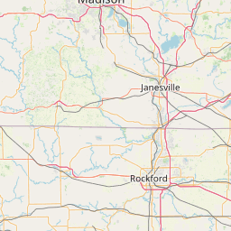
Distance Map Between Moline and Gurnee
Moline, Springfield, United States ↔ Gurnee, Springfield, United States = 147 miles = 236 km.


How far is it between Moline and Gurnee
Moline is located in United States with (41.5067,-90.5151) coordinates and Gurnee is located in United States with (42.3703,-87.902) coordinates. The calculated flying distance from Moline to Gurnee is equal to 147 miles which is equal to 236 km.
If you want to go by car, the driving distance between Moline and Gurnee is 303.65 km. If you ride your car with an average speed of 112 kilometers/hour (70 miles/h), travel time will be 02 hours 42 minutes. Please check the avg. speed travel time table on the right for various options.
Difference between fly and go by a car is 68 km.
| City/Place | Latitude and Longitude | GPS Coordinates |
|---|---|---|
| Moline | 41.5067, -90.5151 | 41° 30´ 24.1200'' N 90° 30´ 54.4680'' W |
| Gurnee | 42.3703, -87.902 | 42° 22´ 13.0800'' N 87° 54´ 7.2720'' W |
Estimated Travel Time Between Moline and Gurnee
| Average Speed | Travel Time |
|---|---|
| 30 mph (48 km/h) | 06 hours 19 minutes |
| 40 mph (64 km/h) | 04 hours 44 minutes |
| 50 mph (80 km/h) | 03 hours 47 minutes |
| 60 mph (97 km/h) | 03 hours 07 minutes |
| 70 mph (112 km/h) | 02 hours 42 minutes |
| 75 mph (120 km/h) | 02 hours 31 minutes |
Related Distances from Moline
| Cities | Distance |
|---|---|
| Moline to Chicago | 277 km |
| Moline to Galesburg | 80 km |
| Moline to Macomb | 126 km |
| Moline to Bloomington 3 | 213 km |
| Moline to East Peoria | 153 km |
Related Distances to Gurnee
| Cities | Distance |
|---|---|
| Northbrook to Gurnee | 33 km |
| Schaumburg to Gurnee | 70 km |
| Niles to Gurnee | 47 km |
| Naperville to Gurnee | 86 km |
| Highland Park to Gurnee | 25 km |