Distance from Montevideo to Avare
Distance between Montevideo and Avare is 1489 kilometers (925 miles).
Driving distance from Montevideo to Avare is 1978 kilometers (1229 miles).
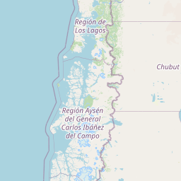
Distance Map Between Montevideo and Avare
Montevideo, Uruguay ↔ Avare, Sao Paulo, Brazil = 925 miles = 1489 km.


How far is it between Montevideo and Avaré
Montevideo is located in Uruguay with (-34.9033,-56.1882) coordinates and Avare is located in Brazil with (-23.0986,-48.9258) coordinates. The calculated flying distance from Montevideo to Avare is equal to 925 miles which is equal to 1489 km.
If you want to go by car, the driving distance between Montevideo and Avare is 1978.36 km. If you ride your car with an average speed of 112 kilometers/hour (70 miles/h), travel time will be 17 hours 39 minutes. Please check the avg. speed travel time table on the right for various options.
Difference between fly and go by a car is 489 km.
| City/Place | Latitude and Longitude | GPS Coordinates |
|---|---|---|
| Montevideo | -34.9033, -56.1882 | 34° 54´ 11.8080'' S 56° 11´ 17.3760'' W |
| Avare | -23.0986, -48.9258 | 23° 5´ 54.9960'' S 48° 55´ 32.9880'' W |
Estimated Travel Time Between Montevideo and Avaré
| Average Speed | Travel Time |
|---|---|
| 30 mph (48 km/h) | 41 hours 12 minutes |
| 40 mph (64 km/h) | 30 hours 54 minutes |
| 50 mph (80 km/h) | 24 hours 43 minutes |
| 60 mph (97 km/h) | 20 hours 23 minutes |
| 70 mph (112 km/h) | 17 hours 39 minutes |
| 75 mph (120 km/h) | 16 hours 29 minutes |
Related Distances from Montevideo
| Cities | Distance |
|---|---|
| Montevideo to Adamantina | 1970 km |
| Montevideo to Aguai | 2097 km |
| Montevideo to Aguas De Lindoia | 2089 km |
| Montevideo to Agudos | 1959 km |
| Montevideo to Alegre | 2659 km |
| Montevideo to Alegrete | 709 km |
| Montevideo to Alem Paraiba | 2430 km |
| Montevideo to Almirante Tamandare | 1564 km |
| Montevideo to Americana | 2034 km |
| Montevideo to Americo Brasiliense | 2192 km |