Distance from Morwa to Nadiad
Distance between Morwa and Nadiad is 103 kilometers (64 miles).
Driving distance from Morwa to Nadiad is 139 kilometers (86 miles).
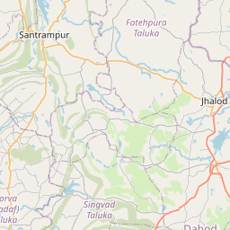
Distance Map Between Morwa and Nadiad
Morwa, Ghandinagar, India ↔ Nadiad, Ghandinagar, India = 64 miles = 103 km.


How far is it between Morwa and Nadiād
Morwa is located in India with (22.9047,73.8391) coordinates and Nadiad is located in India with (22.6939,72.8616) coordinates. The calculated flying distance from Morwa to Nadiad is equal to 64 miles which is equal to 103 km.
If you want to go by car, the driving distance between Morwa and Nadiad is 138.76 km. If you ride your car with an average speed of 112 kilometers/hour (70 miles/h), travel time will be 01 hours 14 minutes. Please check the avg. speed travel time table on the right for various options.
Difference between fly and go by a car is 36 km.
| City/Place | Latitude and Longitude | GPS Coordinates |
|---|---|---|
| Morwa | 22.9047, 73.8391 | 22° 54´ 16.8840'' N 73° 50´ 20.8320'' E |
| Nadiad | 22.6939, 72.8616 | 22° 41´ 37.8600'' N 72° 51´ 41.6520'' E |
Estimated Travel Time Between Morwa and Nadiād
| Average Speed | Travel Time |
|---|---|
| 30 mph (48 km/h) | 02 hours 53 minutes |
| 40 mph (64 km/h) | 02 hours 10 minutes |
| 50 mph (80 km/h) | 01 hours 44 minutes |
| 60 mph (97 km/h) | 01 hours 25 minutes |
| 70 mph (112 km/h) | 01 hours 14 minutes |
| 75 mph (120 km/h) | 01 hours 09 minutes |
Related Distances from Morwa
| Cities | Distance |
|---|---|
| Morwa to Petlad | 169 km |
| Morwa to Rajkot | 369 km |
| Morwa to Surat | 257 km |
| Morwa to Siddhapur | 252 km |
| Morwa to Rajpipla | 178 km |
Related Distances to Nadiad
| Cities | Distance |
|---|---|
| Ahmedabad to Nadiad | 57 km |
| Kapadvanj to Nadiad | 44 km |
| Dholka to Nadiad | 48 km |
| Khambhat to Nadiad | 57 km |
| Borsad to Nadiad | 45 km |