Distance from Moscow to Gdynia
Distance between Moscow and Gdynia is 1217 kilometers (756 miles).
Driving distance from Moscow to Gdynia is 1492 kilometers (927 miles).
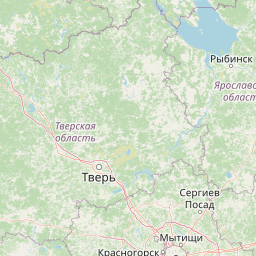
Distance Map Between Moscow and Gdynia
Moscow, Russia ↔ Gdynia, Gdansk, Poland = 756 miles = 1217 km.


How far is it between Moscow and Gdynia
Moscow is located in Russia with (55.7522,37.6156) coordinates and Gdynia is located in Poland with (54.5189,18.5319) coordinates. The calculated flying distance from Moscow to Gdynia is equal to 756 miles which is equal to 1217 km.
If you want to go by car, the driving distance between Moscow and Gdynia is 1491.57 km. If you ride your car with an average speed of 112 kilometers/hour (70 miles/h), travel time will be 13 hours 19 minutes. Please check the avg. speed travel time table on the right for various options.
Difference between fly and go by a car is 275 km.
| City/Place | Latitude and Longitude | GPS Coordinates |
|---|---|---|
| Moscow | 55.7522, 37.6156 | 55° 45´ 7.9920'' N 37° 36´ 56.0160'' E |
| Gdynia | 54.5189, 18.5319 | 54° 31´ 8.0040'' N 18° 31´ 54.7680'' E |
Estimated Travel Time Between Moscow and Gdynia
| Average Speed | Travel Time |
|---|---|
| 30 mph (48 km/h) | 31 hours 04 minutes |
| 40 mph (64 km/h) | 23 hours 18 minutes |
| 50 mph (80 km/h) | 18 hours 38 minutes |
| 60 mph (97 km/h) | 15 hours 22 minutes |
| 70 mph (112 km/h) | 13 hours 19 minutes |
| 75 mph (120 km/h) | 12 hours 25 minutes |
Related Distances from Moscow
| Cities | Distance |
|---|---|
| Moscow to Warsaw | 1261 km |
| Moscow to Krakow | 1525 km |
| Moscow to Bialystok | 1056 km |
| Moscow to Gdansk | 1446 km |
| Moscow to Lublin | 1212 km |
Related Distances to Gdynia
| Cities | Distance |
|---|---|
| Murmansk to Gdynia | 2596 km |
| Moscow to Gdynia | 1492 km |
| Saint Petersburg to Gdynia | 1258 km |
| Apatity to Gdynia | 2458 km |
| Monchegorsk to Gdynia | 2459 km |