Distance from Murrieta to El Monte
Distance between Murrieta and El Monte is 94 kilometers (59 miles).
Driving distance from Murrieta to El Monte is 108 kilometers (67 miles).
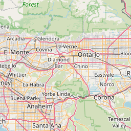
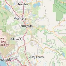
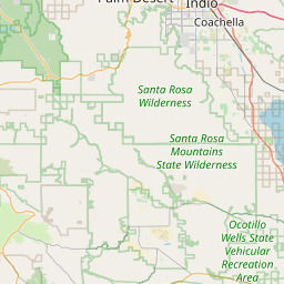
Distance Map Between Murrieta and El Monte
Murrieta, Sacramento, United States ↔ El Monte, Sacramento, United States = 59 miles = 94 km.

How far is it between Murrieta and El Monte
Murrieta is located in United States with (33.5539,-117.2139) coordinates and El Monte is located in United States with (34.0686,-118.0276) coordinates. The calculated flying distance from Murrieta to El Monte is equal to 59 miles which is equal to 94 km.
If you want to go by car, the driving distance between Murrieta and El Monte is 107.99 km. If you ride your car with an average speed of 112 kilometers/hour (70 miles/h), travel time will be 00 hours 57 minutes. Please check the avg. speed travel time table on the right for various options.
Difference between fly and go by a car is 14 km.
| City/Place | Latitude and Longitude | GPS Coordinates |
|---|---|---|
| Murrieta | 33.5539, -117.2139 | 33° 33´ 14.0760'' N 117° 12´ 50.1120'' W |
| El Monte | 34.0686, -118.0276 | 34° 4´ 7.0320'' N 118° 1´ 39.2520'' W |
Estimated Travel Time Between Murrieta and El Monte
| Average Speed | Travel Time |
|---|---|
| 30 mph (48 km/h) | 02 hours 14 minutes |
| 40 mph (64 km/h) | 01 hours 41 minutes |
| 50 mph (80 km/h) | 01 hours 20 minutes |
| 60 mph (97 km/h) | 01 hours 06 minutes |
| 70 mph (112 km/h) | 00 hours 57 minutes |
| 75 mph (120 km/h) | 00 hours 53 minutes |
Related Distances from Murrieta
| Cities | Distance |
|---|---|
| Murrieta to Hemet | 40 km |
| Murrieta to Menifee | 26 km |
| Murrieta to Moreno Valley | 55 km |
| Murrieta to Escondido | 58 km |
| Murrieta to Corona | 53 km |
Related Distances to El Monte
| Cities | Distance |
|---|---|
| Los Angeles to El Monte | 27 km |
| La Puente to El Monte | 12 km |
| Whittier to El Monte | 17 km |
| Ontario to El Monte | 39 km |
| Pasadena 2 to El Monte | 30 km |