Distance from Muscat to Beawar
Distance between Muscat and Beawar is 1610 kilometers (1000 miles).
Driving distance from Muscat to Beawar is 9598 kilometers (5964 miles).
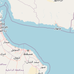
Distance Map Between Muscat and Beawar
Muscat, Oman ↔ Beawar, Jaipur, India = 1000 miles = 1610 km.


How far is it between Muscat and Beāwar
Muscat is located in Oman with (23.6139,58.5922) coordinates and Beawar is located in India with (26.1012,74.3203) coordinates. The calculated flying distance from Muscat to Beawar is equal to 1000 miles which is equal to 1610 km.
If you want to go by car, the driving distance between Muscat and Beawar is 9597.97 km. If you ride your car with an average speed of 112 kilometers/hour (70 miles/h), travel time will be 85 hours 41 minutes. Please check the avg. speed travel time table on the right for various options.
Difference between fly and go by a car is 7988 km.
| City/Place | Latitude and Longitude | GPS Coordinates |
|---|---|---|
| Muscat | 23.6139, 58.5922 | 23° 36´ 49.9320'' N 58° 35´ 31.9200'' E |
| Beawar | 26.1012, 74.3203 | 26° 6´ 4.2840'' N 74° 19´ 13.0080'' E |
Estimated Travel Time Between Muscat and Beāwar
| Average Speed | Travel Time |
|---|---|
| 30 mph (48 km/h) | 199 hours 57 minutes |
| 40 mph (64 km/h) | 149 hours 58 minutes |
| 50 mph (80 km/h) | 119 hours 58 minutes |
| 60 mph (97 km/h) | 98 hours 56 minutes |
| 70 mph (112 km/h) | 85 hours 41 minutes |
| 75 mph (120 km/h) | 79 hours 58 minutes |
Related Distances from Muscat
| Cities | Distance |
|---|---|
| Muscat to Mumbai | 10135 km |
| Muscat to Delhi | 9352 km |
| Muscat to Hyderabad | 9955 km |
| Muscat to Cochin | 11207 km |
| Muscat to Bangalore | 10590 km |