Distance from Nanjangud to Terdal
Distance between Nanjangud and Terdal is 518 kilometers (322 miles).
Driving distance from Nanjangud to Terdal is 698 kilometers (434 miles).
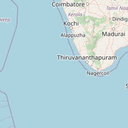
Distance Map Between Nanjangud and Terdal
Nanjangud, Bangalore, India ↔ Terdal, Bangalore, India = 322 miles = 518 km.


How far is it between Nanjangūd and Terdāl
Nanjangud is located in India with (12.118,76.6841) coordinates and Terdal is located in India with (16.4938,75.0467) coordinates. The calculated flying distance from Nanjangud to Terdal is equal to 322 miles which is equal to 518 km.
If you want to go by car, the driving distance between Nanjangud and Terdal is 698.03 km. If you ride your car with an average speed of 112 kilometers/hour (70 miles/h), travel time will be 06 hours 13 minutes. Please check the avg. speed travel time table on the right for various options.
Difference between fly and go by a car is 180 km.
| City/Place | Latitude and Longitude | GPS Coordinates |
|---|---|---|
| Nanjangud | 12.118, 76.6841 | 12° 7´ 4.8720'' N 76° 41´ 2.7960'' E |
| Terdal | 16.4938, 75.0467 | 16° 29´ 37.6440'' N 75° 2´ 48.0120'' E |
Estimated Travel Time Between Nanjangūd and Terdāl
| Average Speed | Travel Time |
|---|---|
| 30 mph (48 km/h) | 14 hours 32 minutes |
| 40 mph (64 km/h) | 10 hours 54 minutes |
| 50 mph (80 km/h) | 08 hours 43 minutes |
| 60 mph (97 km/h) | 07 hours 11 minutes |
| 70 mph (112 km/h) | 06 hours 13 minutes |
| 75 mph (120 km/h) | 05 hours 49 minutes |
Related Distances from Nanjangud
| Cities | Distance |
|---|---|
| Nanjangud to Nelamangala | 181 km |
| Nanjangud to Shimoga | 266 km |
| Nanjangud to Pavagada | 274 km |
| Nanjangud to Tiptur | 165 km |
| Nanjangud to Tumkur | 175 km |
Related Distances to Terdal
| Cities | Distance |
|---|---|
| Jamkhandi to Terdal | 30 km |
| Bagalkot to Terdal | 97 km |
| Hubli to Terdal | 184 km |
| Belgaum to Terdal | 119 km |
| Bijapur to Terdal | 94 km |