Distance from Narwana to Ratia
Distance between Narwana and Ratia is 53 kilometers (33 miles).
Driving distance from Narwana to Ratia is 64 kilometers (40 miles).
Distance Map Between Narwana and Ratia
Narwana, , India ↔ Ratia, , India = 33 miles = 53 km.


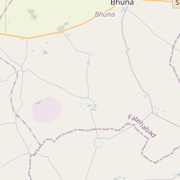


Leaflet | © OpenStreetMap
How far is it between Narwāna and Ratia
Narwana is located in India with (29.5949,76.1182) coordinates and Ratia is located in India with (29.6854,75.5746) coordinates. The calculated flying distance from Narwana to Ratia is equal to 33 miles which is equal to 53 km.
If you want to go by car, the driving distance between Narwana and Ratia is 64.4 km. If you ride your car with an average speed of 112 kilometers/hour (70 miles/h), travel time will be 00 hours 34 minutes. Please check the avg. speed travel time table on the right for various options.
Difference between fly and go by a car is 11 km.
| City/Place | Latitude and Longitude | GPS Coordinates |
|---|---|---|
| Narwana | 29.5949, 76.1182 | 29° 35´ 41.6040'' N 76° 7´ 5.3760'' E |
| Ratia | 29.6854, 75.5746 | 29° 41´ 7.4400'' N 75° 34´ 28.5960'' E |
Estimated Travel Time Between Narwāna and Ratia
| Average Speed | Travel Time |
|---|---|
| 30 mph (48 km/h) | 01 hours 20 minutes |
| 40 mph (64 km/h) | 01 hours 00 minutes |
| 50 mph (80 km/h) | 00 hours 48 minutes |
| 60 mph (97 km/h) | 00 hours 39 minutes |
| 70 mph (112 km/h) | 00 hours 34 minutes |
| 75 mph (120 km/h) | 00 hours 32 minutes |
Narwana, , India
Related Distances from Narwana
| Cities | Distance |
|---|---|
| Narwana to Yamunanagar | 141 km |
| Narwana to Pehowa | 73 km |
| Narwana to Sirsa | 113 km |
| Narwana to Safidon | 77 km |
| Narwana to Panipat | 107 km |
Ratia, , India
Related Distances to Ratia
| Cities | Distance |
|---|---|
| Hisar to Ratia | 76 km |
| Fatehabad to Ratia | 25 km |
| Kaithal to Ratia | 101 km |
| Jind to Ratia | 102 km |
| Karnal to Ratia | 174 km |