Distance from Natick to Agawam
Distance between Natick and Agawam is 107 kilometers (66 miles).
Driving distance from Natick to Agawam is 128 kilometers (80 miles).
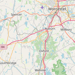
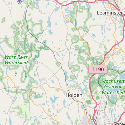
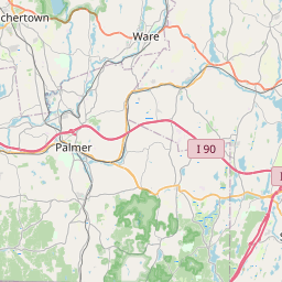
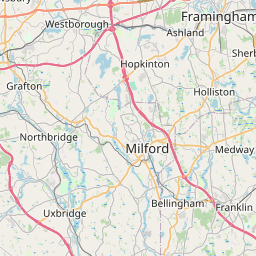
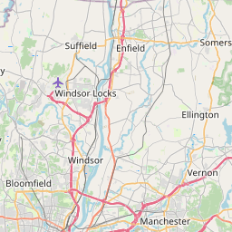
Distance Map Between Natick and Agawam
Natick, Boston, United States ↔ Agawam, Boston, United States = 66 miles = 107 km.

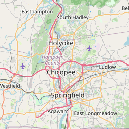
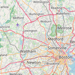

How far is it between Natick and Agawam
Natick is located in United States with (42.2834,-71.3495) coordinates and Agawam is located in United States with (42.0695,-72.6148) coordinates. The calculated flying distance from Natick to Agawam is equal to 66 miles which is equal to 107 km.
If you want to go by car, the driving distance between Natick and Agawam is 128.16 km. If you ride your car with an average speed of 112 kilometers/hour (70 miles/h), travel time will be 01 hours 08 minutes. Please check the avg. speed travel time table on the right for various options.
Difference between fly and go by a car is 21 km.
| City/Place | Latitude and Longitude | GPS Coordinates |
|---|---|---|
| Natick | 42.2834, -71.3495 | 42° 17´ 0.3480'' N 71° 20´ 58.2000'' W |
| Agawam | 42.0695, -72.6148 | 42° 4´ 10.3440'' N 72° 36´ 53.3160'' W |
Estimated Travel Time Between Natick and Agawam
| Average Speed | Travel Time |
|---|---|
| 30 mph (48 km/h) | 02 hours 40 minutes |
| 40 mph (64 km/h) | 02 hours 00 minutes |
| 50 mph (80 km/h) | 01 hours 36 minutes |
| 60 mph (97 km/h) | 01 hours 19 minutes |
| 70 mph (112 km/h) | 01 hours 08 minutes |
| 75 mph (120 km/h) | 01 hours 04 minutes |
Related Distances from Natick
| Cities | Distance |
|---|---|
| Natick to Burlington 5 | 40 km |
| Natick to Framingham | 6 km |
| Natick to Medford 2 | 46 km |
| Natick to Cambridge 3 | 32 km |
| Natick to Dedham | 18 km |
Related Distances to Agawam
| Cities | Distance |
|---|---|
| South Boston to Agawam | 153 km |
| Springfield 2 to Agawam | 6 km |
| Franklin 3 to Agawam | 132 km |
| West Springfield to Agawam | 5 km |
| Northampton 2 to Agawam | 37 km |