Distance from Nikulino to Severnyy
Distance between Nikulino and Severnyy is 30 kilometers (19 miles).
Driving distance from Nikulino to Severnyy is 42 kilometers (26 miles).
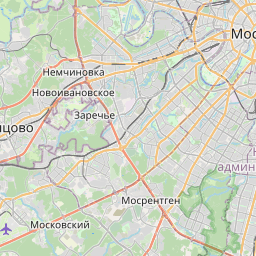
Distance Map Between Nikulino and Severnyy
Nikulino, Moscow, Russia ↔ Severnyy, Moscow, Russia = 19 miles = 30 km.


How far is it between Nikulino and Severnyy
Nikulino is located in Russia with (55.6694,37.466) coordinates and Severnyy is located in Russia with (55.9358,37.5489) coordinates. The calculated flying distance from Nikulino to Severnyy is equal to 19 miles which is equal to 30 km.
If you want to go by car, the driving distance between Nikulino and Severnyy is 41.58 km. If you ride your car with an average speed of 112 kilometers/hour (70 miles/h), travel time will be 00 hours 22 minutes. Please check the avg. speed travel time table on the right for various options.
Difference between fly and go by a car is 12 km.
| City/Place | Latitude and Longitude | GPS Coordinates |
|---|---|---|
| Nikulino | 55.6694, 37.466 | 55° 40´ 9.9480'' N 37° 27´ 57.5280'' E |
| Severnyy | 55.9358, 37.5489 | 55° 56´ 8.9880'' N 37° 32´ 56.0040'' E |
Estimated Travel Time Between Nikulino and Severnyy
| Average Speed | Travel Time |
|---|---|
| 30 mph (48 km/h) | 00 hours 51 minutes |
| 40 mph (64 km/h) | 00 hours 38 minutes |
| 50 mph (80 km/h) | 00 hours 31 minutes |
| 60 mph (97 km/h) | 00 hours 25 minutes |
| 70 mph (112 km/h) | 00 hours 22 minutes |
| 75 mph (120 km/h) | 00 hours 20 minutes |
Related Distances from Nikulino
| Cities | Distance |
|---|---|
| Nikulino to Zelenograd | 63 km |
| Nikulino to Tekstil Shchiki | 24 km |
| Nikulino to Ryazanskiy | 27 km |
| Nikulino to Novo Peredelkino | 12 km |
| Nikulino to Zhulebino | 43 km |
Related Distances to Severnyy
| Cities | Distance |
|---|---|
| Khimki to Severnyy | 19 km |
| Ramenki to Severnyy | 44 km |
| Biryulevo to Severnyy | 59 km |
| Novokuz Minki to Severnyy | 42 km |
| Pokrovskoye Streshnevo to Severnyy | 24 km |