Distance from North Bel Air to Elkton
Distance between North Bel Air and Elkton is 45 kilometers (28 miles).
Driving distance from North Bel Air to Elkton is 58 kilometers (36 miles).
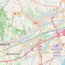
Distance Map Between North Bel Air and Elkton
North Bel Air, Annapolis, United States ↔ Elkton, Annapolis, United States = 28 miles = 45 km.


How far is it between North Bel Air and Elkton
North Bel Air is located in United States with (39.5398,-76.355) coordinates and Elkton is located in United States with (39.6068,-75.8333) coordinates. The calculated flying distance from North Bel Air to Elkton is equal to 28 miles which is equal to 45 km.
If you want to go by car, the driving distance between North Bel Air and Elkton is 57.5 km. If you ride your car with an average speed of 112 kilometers/hour (70 miles/h), travel time will be 00 hours 30 minutes. Please check the avg. speed travel time table on the right for various options.
Difference between fly and go by a car is 13 km.
| City/Place | Latitude and Longitude | GPS Coordinates |
|---|---|---|
| North Bel Air | 39.5398, -76.355 | 39° 32´ 23.3880'' N 76° 21´ 17.8560'' W |
| Elkton | 39.6068, -75.8333 | 39° 36´ 24.4080'' N 75° 49´ 59.7720'' W |
Estimated Travel Time Between North Bel Air and Elkton
| Average Speed | Travel Time |
|---|---|
| 30 mph (48 km/h) | 01 hours 11 minutes |
| 40 mph (64 km/h) | 00 hours 53 minutes |
| 50 mph (80 km/h) | 00 hours 43 minutes |
| 60 mph (97 km/h) | 00 hours 35 minutes |
| 70 mph (112 km/h) | 00 hours 30 minutes |
| 75 mph (120 km/h) | 00 hours 28 minutes |
Related Distances from North Bel Air
| Cities | Distance |
|---|---|
| North Bel Air to Elkton | 58 km |
| North Bel Air to Essex | 38 km |
| North Bel Air to Middle River | 36 km |
| North Bel Air to Montgomery Village | 119 km |
| North Bel Air to Cockeysville | 33 km |
Related Distances to Elkton
| Cities | Distance |
|---|---|
| North Bel Air to Elkton | 58 km |
| Laurel to Elkton | 120 km |
| Middle River to Elkton | 79 km |
| Ellicott City to Elkton | 115 km |
| Glen Burnie to Elkton | 104 km |