Distance from Ocala to Key West
Distance between Ocala and Key West is 516 kilometers (321 miles).
Driving distance from Ocala to Key West is 743 kilometers (462 miles).
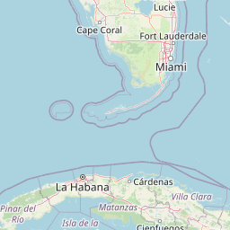
Distance Map Between Ocala and Key West
Ocala, Tallahassee, United States ↔ Key West, Tallahassee, United States = 321 miles = 516 km.


How far is it between Ocala and Key West
Ocala is located in United States with (29.1872,-82.1401) coordinates and Key West is located in United States with (24.5557,-81.7826) coordinates. The calculated flying distance from Ocala to Key West is equal to 321 miles which is equal to 516 km.
If you want to go by car, the driving distance between Ocala and Key West is 743.05 km. If you ride your car with an average speed of 112 kilometers/hour (70 miles/h), travel time will be 06 hours 38 minutes. Please check the avg. speed travel time table on the right for various options.
Difference between fly and go by a car is 227 km.
| City/Place | Latitude and Longitude | GPS Coordinates |
|---|---|---|
| Ocala | 29.1872, -82.1401 | 29° 11´ 13.9200'' N 82° 8´ 24.3240'' W |
| Key West | 24.5557, -81.7826 | 24° 33´ 20.5200'' N 81° 46´ 57.3240'' W |
Estimated Travel Time Between Ocala and Key West
| Average Speed | Travel Time |
|---|---|
| 30 mph (48 km/h) | 15 hours 28 minutes |
| 40 mph (64 km/h) | 11 hours 36 minutes |
| 50 mph (80 km/h) | 09 hours 17 minutes |
| 60 mph (97 km/h) | 07 hours 39 minutes |
| 70 mph (112 km/h) | 06 hours 38 minutes |
| 75 mph (120 km/h) | 06 hours 11 minutes |
Related Distances from Ocala
| Cities | Distance |
|---|---|
| Ocala to Daytona Beach | 125 km |
| Ocala to Miami | 487 km |
| Ocala to Melbourne 2 | 238 km |
| Ocala to Gainesville | 61 km |
| Ocala to Kissimmee | 146 km |
Related Distances to Key West
| Cities | Distance |
|---|---|
| Miami to Key West | 263 km |
| Orlando to Key West | 633 km |
| West Palm Beach to Key West | 374 km |
| Sarasota to Key West | 605 km |
| Pensacola to Key West | 1339 km |