Distance from Olney to Carney
Distance between Olney and Carney is 54 kilometers (33 miles).
Distance Map Between Olney and Carney
Olney, Annapolis, United States ↔ Carney, Annapolis, United States = 33 miles = 54 km.
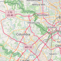


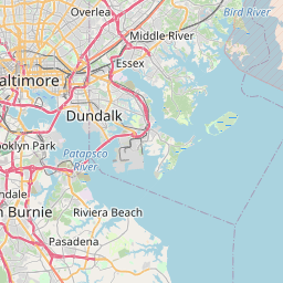
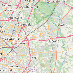


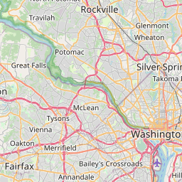
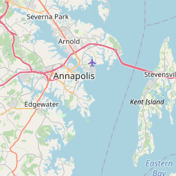


Leaflet | © OpenStreetMap
How far is it between Olney and Carney
Olney is located in United States with (39.1532,-77.0669) coordinates and Carney is located in United States with (39.3943,-76.5236) coordinates. The calculated flying distance from Olney to Carney is equal to 33 miles which is equal to 54 km.
| City/Place | Latitude and Longitude | GPS Coordinates |
|---|---|---|
| Olney | 39.1532, -77.0669 | 39° 9´ 11.3760'' N 77° 4´ 0.9120'' W |
| Carney | 39.3943, -76.5236 | 39° 23´ 39.3720'' N 76° 31´ 24.8880'' W |
Olney, Annapolis, United States
Related Distances from Olney
| Cities | Distance |
|---|---|
| Olney to Columbia 3 | 45 km |
| Olney to Baltimore | 59 km |
| Olney to Germantown | 28 km |
| Olney to Odenton | 50 km |
| Olney to North Potomac | 25 km |
Carney, Annapolis, United States
Related Distances to Carney
| Cities | Distance |
|---|---|
| Dundalk to Carney | 19 km |
| Fort Washington to Carney | 106 km |
| Glen Burnie to Carney | 33 km |
| Middle River to Carney | 14 km |
| Milford Mill to Carney | 30 km |