Distance from Orangeville to Brantford
Distance between Orangeville and Brantford is 88 kilometers (55 miles).
Driving distance from Orangeville to Brantford is 141 kilometers (88 miles).
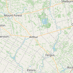
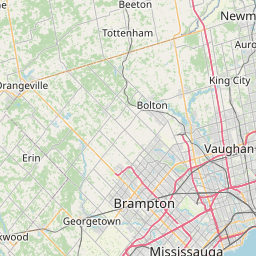
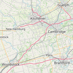
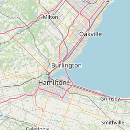
Distance Map Between Orangeville and Brantford
Orangeville, Ontario, Canada ↔ Brantford, Ontario, Canada = 55 miles = 88 km.


How far is it between Orangeville and Brantford
Orangeville is located in Canada with (43.9168,-80.0997) coordinates and Brantford is located in Canada with (43.1334,-80.2664) coordinates. The calculated flying distance from Orangeville to Brantford is equal to 55 miles which is equal to 88 km.
If you want to go by car, the driving distance between Orangeville and Brantford is 141.33 km. If you ride your car with an average speed of 112 kilometers/hour (70 miles/h), travel time will be 01 hours 15 minutes. Please check the avg. speed travel time table on the right for various options.
Difference between fly and go by a car is 53 km.
| City/Place | Latitude and Longitude | GPS Coordinates |
|---|---|---|
| Orangeville | 43.9168, -80.0997 | 43° 55´ 0.4800'' N 80° 5´ 58.8120'' W |
| Brantford | 43.1334, -80.2664 | 43° 8´ 0.2400'' N 80° 15´ 58.8960'' W |
Estimated Travel Time Between Orangeville and Brantford
| Average Speed | Travel Time |
|---|---|
| 30 mph (48 km/h) | 02 hours 56 minutes |
| 40 mph (64 km/h) | 02 hours 12 minutes |
| 50 mph (80 km/h) | 01 hours 45 minutes |
| 60 mph (97 km/h) | 01 hours 27 minutes |
| 70 mph (112 km/h) | 01 hours 15 minutes |
| 75 mph (120 km/h) | 01 hours 10 minutes |
Related Distances from Orangeville
| Cities | Distance |
|---|---|
| Orangeville to Brampton | 39 km |
| Orangeville to Barrie | 89 km |
| Orangeville to Mississauga | 60 km |
| Orangeville to London 2 | 174 km |
| Orangeville to Guelph | 56 km |
Related Distances to Brantford
| Cities | Distance |
|---|---|
| Toronto to Brantford | 115 km |
| Hamilton to Brantford | 42 km |
| Waterloo to Brantford | 52 km |
| London 2 to Brantford | 93 km |
| Kitchener to Brantford | 45 km |