Distance from Ordu to Mosul
Distance between Ordu and Mosul is 688 kilometers (428 miles).
Driving distance from Ordu to Mosul is 1066 kilometers (663 miles).
Distance Map Between Ordu and Mosul
Ordu, Turkey ↔ Mosul, Iraq = 428 miles = 688 km.


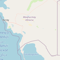


Leaflet | © OpenStreetMap
How far is it between Ordu and Mosul
Ordu is located in Turkey with (40.9847,37.8789) coordinates and Mosul is located in Iraq with (36.335,43.1189) coordinates. The calculated flying distance from Ordu to Mosul is equal to 428 miles which is equal to 688 km.
If you want to go by car, the driving distance between Ordu and Mosul is 1066.49 km. If you ride your car with an average speed of 112 kilometers/hour (70 miles/h), travel time will be 09 hours 31 minutes. Please check the avg. speed travel time table on the right for various options.
Difference between fly and go by a car is 378 km.
| City/Place | Latitude and Longitude | GPS Coordinates |
|---|---|---|
| Ordu | 40.9847, 37.8789 | 40° 59´ 4.9920'' N 37° 52´ 44.0040'' E |
| Mosul | 36.335, 43.1189 | 36° 20´ 6.0000'' N 43° 7´ 8.0040'' E |
Estimated Travel Time Between Ordu and Mosul
| Average Speed | Travel Time |
|---|---|
| 30 mph (48 km/h) | 22 hours 13 minutes |
| 40 mph (64 km/h) | 16 hours 39 minutes |
| 50 mph (80 km/h) | 13 hours 19 minutes |
| 60 mph (97 km/h) | 10 hours 59 minutes |
| 70 mph (112 km/h) | 09 hours 31 minutes |
| 75 mph (120 km/h) | 08 hours 53 minutes |
Ordu, Turkey
Related Distances from Ordu
| Cities | Distance |
|---|---|
| Ordu to Al Basrat Al Qadimah | 2008 km |
| Ordu to Mosul | 1066 km |
| Ordu to Al Basrah | 2015 km |
| Ordu to Al Mawsil Al Jadidah | 1063 km |
| Ordu to Baghdad | 1473 km |
Mosul, Iraq
Related Distances to Mosul
| Cities | Distance |
|---|---|
| Istanbul to Mosul | 1784 km |
| Van to Mosul | 449 km |
| Ankara to Mosul | 1332 km |
| Diyarbakir to Mosul | 434 km |
| Mardin to Mosul | 330 km |