Distance from Oregon to Athens
Distance between Oregon and Athens is 283 kilometers (176 miles).
Driving distance from Oregon to Athens is 331 kilometers (206 miles).
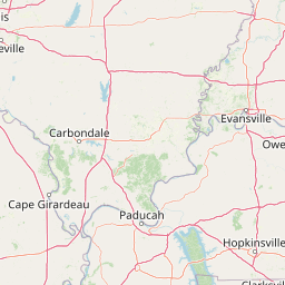
Distance Map Between Oregon and Athens
Oregon, Columbus, United States ↔ Athens, Columbus, United States = 176 miles = 283 km.


How far is it between Oregon and Athens
Oregon is located in United States with (41.6437,-83.4869) coordinates and Athens is located in United States with (39.3292,-82.1013) coordinates. The calculated flying distance from Oregon to Athens is equal to 176 miles which is equal to 283 km.
If you want to go by car, the driving distance between Oregon and Athens is 330.92 km. If you ride your car with an average speed of 112 kilometers/hour (70 miles/h), travel time will be 02 hours 57 minutes. Please check the avg. speed travel time table on the right for various options.
Difference between fly and go by a car is 48 km.
| City/Place | Latitude and Longitude | GPS Coordinates |
|---|---|---|
| Oregon | 41.6437, -83.4869 | 41° 38´ 37.1760'' N 83° 29´ 12.7680'' W |
| Athens | 39.3292, -82.1013 | 39° 19´ 45.2640'' N 82° 6´ 4.5360'' W |
Estimated Travel Time Between Oregon and Athens
| Average Speed | Travel Time |
|---|---|
| 30 mph (48 km/h) | 06 hours 53 minutes |
| 40 mph (64 km/h) | 05 hours 10 minutes |
| 50 mph (80 km/h) | 04 hours 08 minutes |
| 60 mph (97 km/h) | 03 hours 24 minutes |
| 70 mph (112 km/h) | 02 hours 57 minutes |
| 75 mph (120 km/h) | 02 hours 45 minutes |
Related Distances from Oregon
| Cities | Distance |
|---|---|
| Oregon to Delaware | 166 km |
| Oregon to Cleveland | 178 km |
| Oregon to Mansfield 3 | 156 km |
| Oregon to Fairfield 3 | 312 km |
| Oregon to Canton 2 | 247 km |
Related Distances to Athens
| Cities | Distance |
|---|---|
| Berea to Athens 3 | 325 km |
| Troy 3 to Athens 3 | 234 km |
| Youngstown to Athens 3 | 365 km |
| Kent 2 to Athens 3 | 309 km |
| Cincinnati to Athens 3 | 273 km |