Distance from Oregon to Green
Distance between Oregon and Green is 184 kilometers (115 miles).
Driving distance from Oregon to Green is 227 kilometers (141 miles).
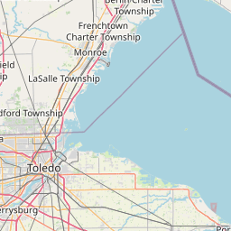
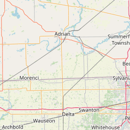
Distance Map Between Oregon and Green
Oregon, Columbus, United States ↔ Green, Columbus, United States = 115 miles = 184 km.


How far is it between Oregon and Green
Oregon is located in United States with (41.6437,-83.4869) coordinates and Green is located in United States with (40.9459,-81.4832) coordinates. The calculated flying distance from Oregon to Green is equal to 115 miles which is equal to 184 km.
If you want to go by car, the driving distance between Oregon and Green is 227.33 km. If you ride your car with an average speed of 112 kilometers/hour (70 miles/h), travel time will be 02 hours 01 minutes. Please check the avg. speed travel time table on the right for various options.
Difference between fly and go by a car is 43 km.
| City/Place | Latitude and Longitude | GPS Coordinates |
|---|---|---|
| Oregon | 41.6437, -83.4869 | 41° 38´ 37.1760'' N 83° 29´ 12.7680'' W |
| Green | 40.9459, -81.4832 | 40° 56´ 45.2040'' N 81° 28´ 59.4120'' W |
Estimated Travel Time Between Oregon and Green
| Average Speed | Travel Time |
|---|---|
| 30 mph (48 km/h) | 04 hours 44 minutes |
| 40 mph (64 km/h) | 03 hours 33 minutes |
| 50 mph (80 km/h) | 02 hours 50 minutes |
| 60 mph (97 km/h) | 02 hours 20 minutes |
| 70 mph (112 km/h) | 02 hours 01 minutes |
| 75 mph (120 km/h) | 01 hours 53 minutes |
Related Distances from Oregon
| Cities | Distance |
|---|---|
| Oregon to Delaware | 166 km |
| Oregon to Cleveland | 178 km |
| Oregon to Mansfield 3 | 156 km |
| Oregon to Fairfield 3 | 312 km |
| Oregon to Canton 2 | 247 km |
Related Distances to Green
| Cities | Distance |
|---|---|
| Milwaukee to Green Bay | 191 km |
| Winston Salem to Greensboro | 48 km |
| Plainfield 3 to Greenwood | 43 km |
| Meridian 2 to Greenville 3 | 343 km |
| Greenwood to Greenfield 2 | 55 km |