Distance from Owensboro to Danville
Distance between Owensboro and Danville is 206 kilometers (128 miles).
Driving distance from Owensboro to Danville is 260 kilometers (162 miles).
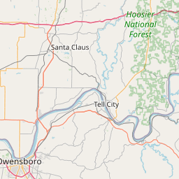
Distance Map Between Owensboro and Danville
Owensboro, Frankfort, United States ↔ Danville, Frankfort, United States = 128 miles = 206 km.


How far is it between Owensboro and Danville
Owensboro is located in United States with (37.7742,-87.1133) coordinates and Danville is located in United States with (37.6456,-84.7722) coordinates. The calculated flying distance from Owensboro to Danville is equal to 128 miles which is equal to 206 km.
If you want to go by car, the driving distance between Owensboro and Danville is 260.28 km. If you ride your car with an average speed of 112 kilometers/hour (70 miles/h), travel time will be 02 hours 19 minutes. Please check the avg. speed travel time table on the right for various options.
Difference between fly and go by a car is 54 km.
| City/Place | Latitude and Longitude | GPS Coordinates |
|---|---|---|
| Owensboro | 37.7742, -87.1133 | 37° 46´ 27.1920'' N 87° 6´ 47.9880'' W |
| Danville | 37.6456, -84.7722 | 37° 38´ 44.2680'' N 84° 46´ 19.8120'' W |
Estimated Travel Time Between Owensboro and Danville
| Average Speed | Travel Time |
|---|---|
| 30 mph (48 km/h) | 05 hours 25 minutes |
| 40 mph (64 km/h) | 04 hours 04 minutes |
| 50 mph (80 km/h) | 03 hours 15 minutes |
| 60 mph (97 km/h) | 02 hours 40 minutes |
| 70 mph (112 km/h) | 02 hours 19 minutes |
| 75 mph (120 km/h) | 02 hours 10 minutes |
Related Distances from Owensboro
| Cities | Distance |
|---|---|
| Owensboro to Elizabethtown | 153 km |
| Owensboro to Bowling Green | 115 km |
| Owensboro to Louisville | 172 km |
| Owensboro to Madisonville | 76 km |
| Owensboro to Paducah | 205 km |
Related Distances to Danville
| Cities | Distance |
|---|---|
| Richmond 6 to Danville 4 | 53 km |
| Louisville to Danville 4 | 134 km |
| Lexington to Danville 4 | 55 km |
| Elizabethtown to Danville 4 | 110 km |
| Winchester 5 to Danville 4 | 90 km |