Distance from Ozar to Palghar
Distance between Ozar and Palghar is 129 kilometers (80 miles).
Driving distance from Ozar to Palghar is 183 kilometers (114 miles).
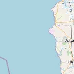
Distance Map Between Ozar and Palghar
Ozar, Mumbai, India ↔ Palghar, Mumbai, India = 80 miles = 129 km.


How far is it between Ozar and Pālghar
Ozar is located in India with (20.0947,73.9282) coordinates and Palghar is located in India with (19.6969,72.7654) coordinates. The calculated flying distance from Ozar to Palghar is equal to 80 miles which is equal to 129 km.
If you want to go by car, the driving distance between Ozar and Palghar is 182.74 km. If you ride your car with an average speed of 112 kilometers/hour (70 miles/h), travel time will be 01 hours 37 minutes. Please check the avg. speed travel time table on the right for various options.
Difference between fly and go by a car is 54 km.
| City/Place | Latitude and Longitude | GPS Coordinates |
|---|---|---|
| Ozar | 20.0947, 73.9282 | 20° 5´ 41.0280'' N 73° 55´ 41.3760'' E |
| Palghar | 19.6969, 72.7654 | 19° 41´ 48.9480'' N 72° 45´ 55.5480'' E |
Estimated Travel Time Between Ozar and Pālghar
| Average Speed | Travel Time |
|---|---|
| 30 mph (48 km/h) | 03 hours 48 minutes |
| 40 mph (64 km/h) | 02 hours 51 minutes |
| 50 mph (80 km/h) | 02 hours 17 minutes |
| 60 mph (97 km/h) | 01 hours 53 minutes |
| 70 mph (112 km/h) | 01 hours 37 minutes |
| 75 mph (120 km/h) | 01 hours 31 minutes |
Related Distances from Ozar
| Cities | Distance |
|---|---|
| Ozar to Pune | 219 km |
| Ozar to Sangamner | 83 km |
| Ozar to Shirdi | 85 km |
| Ozar to Panvel | 189 km |
| Ozar to Yeola | 70 km |
Related Distances to Palghar
| Cities | Distance |
|---|---|
| Navi Mumbai to Palghar | 117 km |
| Bhayandar to Palghar | 86 km |
| Powai to Palghar | 103 km |
| Kalyan to Palghar | 101 km |
| Airoli to Palghar | 104 km |