Distance from Ozar to Yeola
Distance between Ozar and Yeola is 59 kilometers (37 miles).
Driving distance from Ozar to Yeola is 70 kilometers (43 miles).
Distance Map Between Ozar and Yeola
Ozar, Mumbai, India ↔ Yeola, Mumbai, India = 37 miles = 59 km.


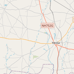


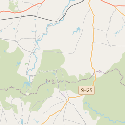

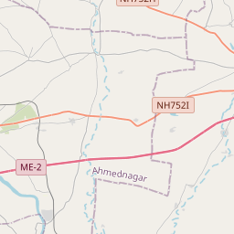

Leaflet | © OpenStreetMap
How far is it between Ozar and Yeola
Ozar is located in India with (20.0947,73.9282) coordinates and Yeola is located in India with (20.0426,74.4899) coordinates. The calculated flying distance from Ozar to Yeola is equal to 37 miles which is equal to 59 km.
If you want to go by car, the driving distance between Ozar and Yeola is 69.5 km. If you ride your car with an average speed of 112 kilometers/hour (70 miles/h), travel time will be 00 hours 37 minutes. Please check the avg. speed travel time table on the right for various options.
Difference between fly and go by a car is 11 km.
| City/Place | Latitude and Longitude | GPS Coordinates |
|---|---|---|
| Ozar | 20.0947, 73.9282 | 20° 5´ 41.0280'' N 73° 55´ 41.3760'' E |
| Yeola | 20.0426, 74.4899 | 20° 2´ 33.4320'' N 74° 29´ 23.6760'' E |
Estimated Travel Time Between Ozar and Yeola
| Average Speed | Travel Time |
|---|---|
| 30 mph (48 km/h) | 01 hours 26 minutes |
| 40 mph (64 km/h) | 01 hours 05 minutes |
| 50 mph (80 km/h) | 00 hours 52 minutes |
| 60 mph (97 km/h) | 00 hours 42 minutes |
| 70 mph (112 km/h) | 00 hours 37 minutes |
| 75 mph (120 km/h) | 00 hours 34 minutes |
Ozar, Mumbai, India
Related Distances from Ozar
| Cities | Distance |
|---|---|
| Ozar to Pune | 219 km |
| Ozar to Sangamner | 83 km |
| Ozar to Shirdi | 85 km |
| Ozar to Panvel | 189 km |
| Ozar to Yeola | 70 km |
Yeola, Mumbai, India
Related Distances to Yeola
| Cities | Distance |
|---|---|
| Nashik to Yeola | 83 km |
| Shirdi to Yeola | 33 km |
| Nandgaon to Yeola | 40 km |
| Malegaon to Yeola | 62 km |
| Pune to Yeola | 232 km |