Distance from Paicandu to Palmas
Distance between Paicandu and Palmas is 337 kilometers (209 miles).
Driving distance from Paicandu to Palmas is 504 kilometers (313 miles).
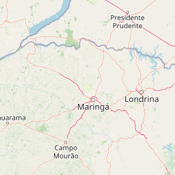
Distance Map Between Paicandu and Palmas
Paicandu, Curitiba, Brazil ↔ Palmas, Curitiba, Brazil = 209 miles = 337 km.


How far is it between Paiçandu and Palmas
Paicandu is located in Brazil with (-23.4575,-52.0486) coordinates and Palmas is located in Brazil with (-26.4842,-51.9906) coordinates. The calculated flying distance from Paicandu to Palmas is equal to 209 miles which is equal to 337 km.
If you want to go by car, the driving distance between Paicandu and Palmas is 504.41 km. If you ride your car with an average speed of 112 kilometers/hour (70 miles/h), travel time will be 04 hours 30 minutes. Please check the avg. speed travel time table on the right for various options.
Difference between fly and go by a car is 167 km.
| City/Place | Latitude and Longitude | GPS Coordinates |
|---|---|---|
| Paicandu | -23.4575, -52.0486 | 23° 27´ 27.0000'' S 52° 2´ 54.9960'' W |
| Palmas | -26.4842, -51.9906 | 26° 29´ 3.0120'' S 51° 59´ 26.0160'' W |
Estimated Travel Time Between Paiçandu and Palmas
| Average Speed | Travel Time |
|---|---|
| 30 mph (48 km/h) | 10 hours 30 minutes |
| 40 mph (64 km/h) | 07 hours 52 minutes |
| 50 mph (80 km/h) | 06 hours 18 minutes |
| 60 mph (97 km/h) | 05 hours 12 minutes |
| 70 mph (112 km/h) | 04 hours 30 minutes |
| 75 mph (120 km/h) | 04 hours 12 minutes |
Related Distances from Paicandu
| Cities | Distance |
|---|---|
| Paicandu to Telemaco Borba | 248 km |
| Paicandu to Paranavai | 81 km |
| Paicandu to Pato Branco | 479 km |
| Paicandu to Santo Antonio Da Platina | 266 km |
| Paicandu to Sao Jose Dos Pinhais | 460 km |
Related Distances to Palmas
| Cities | Distance |
|---|---|
| Coronel Vivida to Palmas 2 | 116 km |
| Campo Mourao to Palmas 2 | 412 km |
| Castro to Palmas 2 | 380 km |
| Cascavel to Palmas 2 | 331 km |
| Campina Grande Do Sul to Palmas 2 | 405 km |