Distance from Paine to Canoas
Distance between Paine and Canoas is 1894 kilometers (1177 miles).
Driving distance from Paine to Canoas is 2404 kilometers (1494 miles).
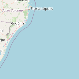
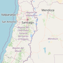
Distance Map Between Paine and Canoas
Paine, Santiago, Chile ↔ Canoas, Porto Alegre, Brazil = 1177 miles = 1894 km.


How far is it between Paine and Canoas
Paine is located in Chile with (-33.808,-70.7411) coordinates and Canoas is located in Brazil with (-29.9178,-51.1836) coordinates. The calculated flying distance from Paine to Canoas is equal to 1177 miles which is equal to 1894 km.
If you want to go by car, the driving distance between Paine and Canoas is 2403.84 km. If you ride your car with an average speed of 112 kilometers/hour (70 miles/h), travel time will be 21 hours 27 minutes. Please check the avg. speed travel time table on the right for various options.
Difference between fly and go by a car is 510 km.
| City/Place | Latitude and Longitude | GPS Coordinates |
|---|---|---|
| Paine | -33.808, -70.7411 | 33° 48´ 28.6560'' S 70° 44´ 27.9240'' W |
| Canoas | -29.9178, -51.1836 | 29° 55´ 4.0080'' S 51° 11´ 0.9960'' W |
Estimated Travel Time Between Paine and Canoas
| Average Speed | Travel Time |
|---|---|
| 30 mph (48 km/h) | 50 hours 04 minutes |
| 40 mph (64 km/h) | 37 hours 33 minutes |
| 50 mph (80 km/h) | 30 hours 02 minutes |
| 60 mph (97 km/h) | 24 hours 46 minutes |
| 70 mph (112 km/h) | 21 hours 27 minutes |
| 75 mph (120 km/h) | 20 hours 01 minutes |
Related Distances from Paine
| Cities | Distance |
|---|---|
| Paine to Campo Grande | 2901 km |
| Paine to Caxias Do Sul | 2545 km |
| Paine to Londrina | 2883 km |
| Paine to Canoas | 2404 km |
Related Distances to Canoas
| Cities | Distance |
|---|---|
| Santiago to Canoas | 2360 km |
| La Pintana to Canoas | 2382 km |
| Puente Alto to Canoas | 2385 km |
| Chimbarongo to Canoas | 2512 km |
| Talagante to Canoas | 2400 km |