Distance from Palitana to Sihor
Distance between Palitana and Sihor is 25 kilometers (16 miles).
Driving distance from Palitana to Sihor is 33 kilometers (21 miles).
Distance Map Between Palitana and Sihor
Palitana, Ghandinagar, India ↔ Sihor, Ghandinagar, India = 16 miles = 25 km.
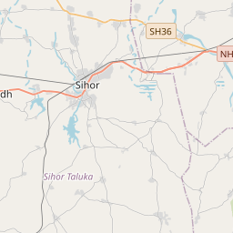
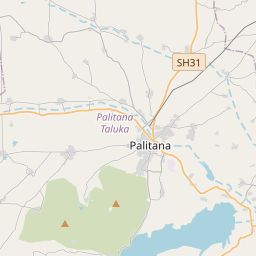

How far is it between Pālitāna and Sihor
Palitana is located in India with (21.5252,71.8231) coordinates and Sihor is located in India with (21.7113,71.9618) coordinates. The calculated flying distance from Palitana to Sihor is equal to 16 miles which is equal to 25 km.
If you want to go by car, the driving distance between Palitana and Sihor is 33.03 km. If you ride your car with an average speed of 112 kilometers/hour (70 miles/h), travel time will be 00 hours 17 minutes. Please check the avg. speed travel time table on the right for various options.
Difference between fly and go by a car is 8 km.
| City/Place | Latitude and Longitude | GPS Coordinates |
|---|---|---|
| Palitana | 21.5252, 71.8231 | 21° 31´ 30.6840'' N 71° 49´ 23.1240'' E |
| Sihor | 21.7113, 71.9618 | 21° 42´ 40.8240'' N 71° 57´ 42.4440'' E |
Estimated Travel Time Between Pālitāna and Sihor
| Average Speed | Travel Time |
|---|---|
| 30 mph (48 km/h) | 00 hours 41 minutes |
| 40 mph (64 km/h) | 00 hours 30 minutes |
| 50 mph (80 km/h) | 00 hours 24 minutes |
| 60 mph (97 km/h) | 00 hours 20 minutes |
| 70 mph (112 km/h) | 00 hours 17 minutes |
| 75 mph (120 km/h) | 00 hours 16 minutes |
Related Distances from Palitana
| Cities | Distance |
|---|---|
| Palitana to Talaja | 35 km |
| Palitana to Patan 2 | 318 km |
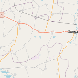
| Palitana to Songadh | 439 km |
| Palitana to Surat | 401 km |
| Palitana to Rajkot | 167 km |
Related Distances to Sihor
| Cities | Distance |
|---|---|
| Bhavnagar to Sihor | 24 km |
| Jabalpur to Sihora | 42 km |
| Sagar to Sihora | 170 km |
| Chhindwara to Sihora | 251 km |
| Rajkot to Sihor | 152 km |