Distance from Palm Bay to Davie
Distance between Palm Bay and Davie is 222 kilometers (138 miles).
Driving distance from Palm Bay to Davie is 243 kilometers (151 miles).
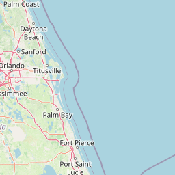
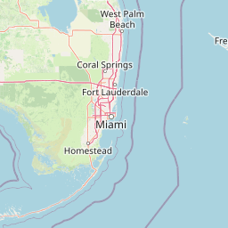
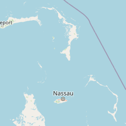
Distance Map Between Palm Bay and Davie
Palm Bay, Tallahassee, United States ↔ Davie, Tallahassee, United States = 138 miles = 222 km.


How far is it between Palm Bay and Davie
Palm Bay is located in United States with (28.0345,-80.5887) coordinates and Davie is located in United States with (26.0629,-80.2331) coordinates. The calculated flying distance from Palm Bay to Davie is equal to 138 miles which is equal to 222 km.
If you want to go by car, the driving distance between Palm Bay and Davie is 243.37 km. If you ride your car with an average speed of 112 kilometers/hour (70 miles/h), travel time will be 02 hours 10 minutes. Please check the avg. speed travel time table on the right for various options.
Difference between fly and go by a car is 21 km.
| City/Place | Latitude and Longitude | GPS Coordinates |
|---|---|---|
| Palm Bay | 28.0345, -80.5887 | 28° 2´ 4.0560'' N 80° 35´ 19.1760'' W |
| Davie | 26.0629, -80.2331 | 26° 3´ 46.3320'' N 80° 13´ 59.1600'' W |
Estimated Travel Time Between Palm Bay and Davie
| Average Speed | Travel Time |
|---|---|
| 30 mph (48 km/h) | 05 hours 04 minutes |
| 40 mph (64 km/h) | 03 hours 48 minutes |
| 50 mph (80 km/h) | 03 hours 02 minutes |
| 60 mph (97 km/h) | 02 hours 30 minutes |
| 70 mph (112 km/h) | 02 hours 10 minutes |
| 75 mph (120 km/h) | 02 hours 01 minutes |
Related Distances from Palm Bay
| Cities | Distance |
|---|---|
| Palm Bay to Allapattah | 272 km |
| Palm Bay to Altamonte Springs | 136 km |
| Palm Bay to Apopka | 156 km |
| Palm Bay to Aventura | 265 km |
| Palm Bay to Bartow | 177 km |
| Palm Bay to Bayonet Point | 292 km |
| Palm Bay to Bayshore Gardens | 301 km |
| Palm Bay to Belle Glade | 191 km |
| Palm Bay to Bellview | 843 km |
| Palm Bay to Boca Raton | 217 km |
Related Distances to Davie
| Cities | Distance |
|---|---|
| Westchase to Davie | 435 km |
| Miami Beach to Davie | 42 km |
| Miami Gardens to Davie | 18 km |
| Homestead to Davie | 91 km |
| Fort Lauderdale to Davie | 16 km |
| Deerfield Beach to Davie | 39 km |
| Naples to Davie | 166 km |
| Parkland 2 to Davie | 41 km |
| Miami to Davie | 37 km |
| Tamiami to Davie | 51 km |