Distance from Pano Aqil to Thul
Distance between Pano Aqil and Thul is 54 kilometers (33 miles).
Driving distance from Pano Aqil to Thul is 119 kilometers (74 miles).
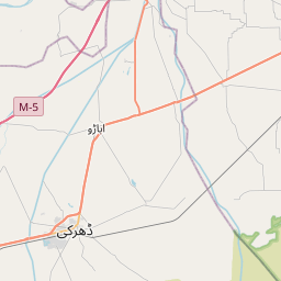
Distance Map Between Pano Aqil and Thul
Pano Aqil, Karachi, Pakistan ↔ Thul, Karachi, Pakistan = 33 miles = 54 km.


How far is it between Pāno Āqil and Thul
Pano Aqil is located in Pakistan with (27.8569,69.1116) coordinates and Thul is located in Pakistan with (28.2404,68.7759) coordinates. The calculated flying distance from Pano Aqil to Thul is equal to 33 miles which is equal to 54 km.
If you want to go by car, the driving distance between Pano Aqil and Thul is 118.75 km. If you ride your car with an average speed of 112 kilometers/hour (70 miles/h), travel time will be 01 hours 03 minutes. Please check the avg. speed travel time table on the right for various options.
Difference between fly and go by a car is 65 km.
| City/Place | Latitude and Longitude | GPS Coordinates |
|---|---|---|
| Pano Aqil | 27.8569, 69.1116 | 27° 51´ 24.6600'' N 69° 6´ 41.6160'' E |
| Thul | 28.2404, 68.7759 | 28° 14´ 25.2600'' N 68° 46´ 33.1680'' E |
Estimated Travel Time Between Pāno Āqil and Thul
| Average Speed | Travel Time |
|---|---|
| 30 mph (48 km/h) | 02 hours 28 minutes |
| 40 mph (64 km/h) | 01 hours 51 minutes |
| 50 mph (80 km/h) | 01 hours 29 minutes |
| 60 mph (97 km/h) | 01 hours 13 minutes |
| 70 mph (112 km/h) | 01 hours 03 minutes |
| 75 mph (120 km/h) | 00 hours 59 minutes |
Related Distances from Pano Aqil
| Cities | Distance |
|---|---|
| Pano Aqil to Sukkur | 38 km |
| Pano Aqil to Rohri | 32 km |
| Pano Aqil to Khairpur | 57 km |
| Pano Aqil to Shikarpur | 82 km |
| Pano Aqil to Ubauro | 83 km |
Related Distances to Thul
| Cities | Distance |
|---|---|
| Jacobabad to Thul | 36 km |
| Sukkur to Thul | 75 km |
| Shikarpur to Thul | 38 km |
| Larkana to Thul | 118 km |
| Hyderabad 2 to Thul | 396 km |