Distance from Passaic to Camden
Distance between Passaic and Camden is 133 kilometers (83 miles).
Driving distance from Passaic to Camden is 161 kilometers (100 miles).
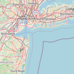
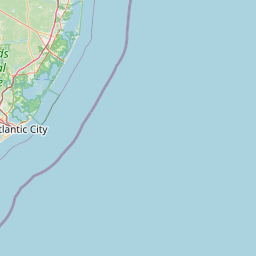
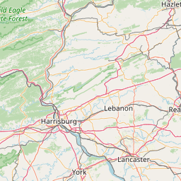
Distance Map Between Passaic and Camden
Passaic, Trenton, United States ↔ Camden, Trenton, United States = 83 miles = 133 km.


How far is it between Passaic and Camden
Passaic is located in United States with (40.8568,-74.1285) coordinates and Camden is located in United States with (39.926,-75.1196) coordinates. The calculated flying distance from Passaic to Camden is equal to 83 miles which is equal to 133 km.
If you want to go by car, the driving distance between Passaic and Camden is 160.51 km. If you ride your car with an average speed of 112 kilometers/hour (70 miles/h), travel time will be 01 hours 25 minutes. Please check the avg. speed travel time table on the right for various options.
Difference between fly and go by a car is 28 km.
| City/Place | Latitude and Longitude | GPS Coordinates |
|---|---|---|
| Passaic | 40.8568, -74.1285 | 40° 51´ 24.3720'' N 74° 7´ 42.5280'' W |
| Camden | 39.926, -75.1196 | 39° 55´ 33.4200'' N 75° 7´ 10.6320'' W |
Estimated Travel Time Between Passaic and Camden
| Average Speed | Travel Time |
|---|---|
| 30 mph (48 km/h) | 03 hours 20 minutes |
| 40 mph (64 km/h) | 02 hours 30 minutes |
| 50 mph (80 km/h) | 02 hours 00 minutes |
| 60 mph (97 km/h) | 01 hours 39 minutes |
| 70 mph (112 km/h) | 01 hours 25 minutes |
| 75 mph (120 km/h) | 01 hours 20 minutes |
Related Distances from Passaic
| Cities | Distance |
|---|---|
| Passaic to Lakewood 4 | 113 km |
| Passaic to Orange 3 | 22 km |
| Passaic to Bergenfield | 22 km |
| Passaic to North Bergen | 18 km |
| Passaic to Cherry Hill | 145 km |
Related Distances to Camden
| Cities | Distance |
|---|---|
| Newark to Camden | 141 km |
| New Brunswick to Camden | 108 km |
| Atlantic City to Camden | 92 km |
| Jersey City to Camden | 147 km |
| East Brunswick to Camden | 102 km |