Distance from Payson to Lehi
Distance between Payson and Lehi is 40 kilometers (25 miles).
Driving distance from Payson to Lehi is 50 kilometers (31 miles).
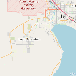
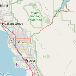
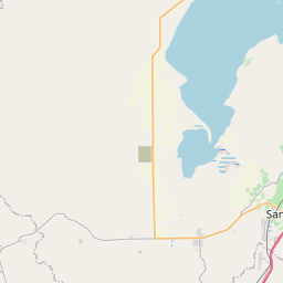
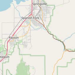
Distance Map Between Payson and Lehi
Payson, Salt Lake City, United States ↔ Lehi, Salt Lake City, United States = 25 miles = 40 km.

How far is it between Payson and Lehi
Payson is located in United States with (40.0444,-111.7322) coordinates and Lehi is located in United States with (40.3916,-111.8508) coordinates. The calculated flying distance from Payson to Lehi is equal to 25 miles which is equal to 40 km.
If you want to go by car, the driving distance between Payson and Lehi is 49.85 km. If you ride your car with an average speed of 112 kilometers/hour (70 miles/h), travel time will be 00 hours 26 minutes. Please check the avg. speed travel time table on the right for various options.
Difference between fly and go by a car is 10 km.
| City/Place | Latitude and Longitude | GPS Coordinates |
|---|---|---|
| Payson | 40.0444, -111.7322 | 40° 2´ 39.8400'' N 111° 43´ 55.7400'' W |
| Lehi | 40.3916, -111.8508 | 40° 23´ 29.8320'' N 111° 51´ 2.7720'' W |
Estimated Travel Time Between Payson and Lehi
| Average Speed | Travel Time |
|---|---|
| 30 mph (48 km/h) | 01 hours 02 minutes |
| 40 mph (64 km/h) | 00 hours 46 minutes |
| 50 mph (80 km/h) | 00 hours 37 minutes |
| 60 mph (97 km/h) | 00 hours 30 minutes |
| 70 mph (112 km/h) | 00 hours 26 minutes |
| 75 mph (120 km/h) | 00 hours 24 minutes |
Related Distances from Payson
| Cities | Distance |
|---|---|
| Payson to Lehi | 50 km |
| Payson to Orem | 36 km |
| Payson to Cedar City | 314 km |
| Payson to Eagle Mountain | 69 km |
| Payson to North Salt Lake | 104 km |
Related Distances to Lehi
| Cities | Distance |
|---|---|
| Naples to Lehigh Acres | 75 km |
| Miami to Lehigh Acres | 222 km |
| West Palm Beach to Lehigh Acres | 184 km |
| Provo to Lehi | 27 km |
| Orem to Lehi | 19 km |