Distance from Peabody to Malden
Distance between Peabody and Malden is 16 kilometers (10 miles).
Driving distance from Peabody to Malden is 21 kilometers (13 miles).
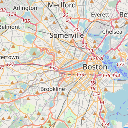
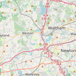
Distance Map Between Peabody and Malden
Peabody, Boston, United States ↔ Malden, Boston, United States = 10 miles = 16 km.
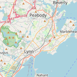


How far is it between Peabody and Malden
Peabody is located in United States with (42.5279,-70.9287) coordinates and Malden is located in United States with (42.4251,-71.0662) coordinates. The calculated flying distance from Peabody to Malden is equal to 10 miles which is equal to 16 km.
If you want to go by car, the driving distance between Peabody and Malden is 21.41 km. If you ride your car with an average speed of 112 kilometers/hour (70 miles/h), travel time will be 00 hours 11 minutes. Please check the avg. speed travel time table on the right for various options.
Difference between fly and go by a car is 5 km.
| City/Place | Latitude and Longitude | GPS Coordinates |
|---|---|---|
| Peabody | 42.5279, -70.9287 | 42° 31´ 40.3320'' N 70° 55´ 43.1760'' W |
| Malden | 42.4251, -71.0662 | 42° 25´ 30.3600'' N 71° 3´ 58.1760'' W |
Estimated Travel Time Between Peabody and Malden
| Average Speed | Travel Time |
|---|---|
| 30 mph (48 km/h) | 00 hours 26 minutes |
| 40 mph (64 km/h) | 00 hours 20 minutes |
| 50 mph (80 km/h) | 00 hours 16 minutes |
| 60 mph (97 km/h) | 00 hours 13 minutes |
| 70 mph (112 km/h) | 00 hours 11 minutes |
| 75 mph (120 km/h) | 00 hours 10 minutes |
Related Distances from Peabody
| Cities | Distance |
|---|---|
| Peabody to Abington | 66 km |
| Peabody to Acton 2 | 52 km |
| Peabody to Agawam | 178 km |
| Peabody to Amesbury | 43 km |
| Peabody to Amherst Center | 167 km |
| Peabody to Arlington 3 | 34 km |
| Peabody to Ashland 5 | 71 km |
| Peabody to Attleboro | 101 km |
| Peabody to Auburn 5 | 102 km |
| Peabody to Barnstable | 143 km |
Related Distances to Malden
| Cities | Distance |
|---|---|
| Westford to Malden | 50 km |
| Melrose to Malden | 4 km |
| Newton to Malden | 26 km |
| Weymouth to Malden | 37 km |
| Milton 3 to Malden | 25 km |
| Methuen to Malden | 40 km |
| Salem 3 to Malden | 26 km |
| Norton 2 to Malden | 73 km |
| Norwood to Malden | 46 km |
| Saugus to Malden | 8 km |