Distance from Pembroke to Guelph
Distance between Pembroke and Guelph is 354 kilometers (220 miles).
Driving distance from Pembroke to Guelph is 470 kilometers (292 miles).
Distance Map Between Pembroke and Guelph
Pembroke, Ontario, Canada ↔ Guelph, Ontario, Canada = 220 miles = 354 km.
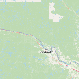


How far is it between Pembroke and Guelph
Pembroke is located in Canada with (45.8168,-77.1162) coordinates and Guelph is located in Canada with (43.5459,-80.256) coordinates. The calculated flying distance from Pembroke to Guelph is equal to 220 miles which is equal to 354 km.
If you want to go by car, the driving distance between Pembroke and Guelph is 470.28 km. If you ride your car with an average speed of 112 kilometers/hour (70 miles/h), travel time will be 04 hours 11 minutes. Please check the avg. speed travel time table on the right for various options.
Difference between fly and go by a car is 116 km.
| City/Place | Latitude and Longitude | GPS Coordinates |
|---|---|---|
| Pembroke | 45.8168, -77.1162 | 45° 49´ 0.5160'' N 77° 6´ 58.1760'' W |
| Guelph | 43.5459, -80.256 | 43° 32´ 45.3840'' N 80° 15´ 21.5640'' W |
Estimated Travel Time Between Pembroke and Guelph
| Average Speed | Travel Time |
|---|---|
| 30 mph (48 km/h) | 09 hours 47 minutes |
| 40 mph (64 km/h) | 07 hours 20 minutes |
| 50 mph (80 km/h) | 05 hours 52 minutes |
| 60 mph (97 km/h) | 04 hours 50 minutes |
| 70 mph (112 km/h) | 04 hours 11 minutes |
| 75 mph (120 km/h) | 03 hours 55 minutes |
Related Distances from Pembroke
| Cities | Distance |
|---|---|
| Pembroke to Ottawa | 147 km |
| Pembroke to Kingston 2 | 250 km |
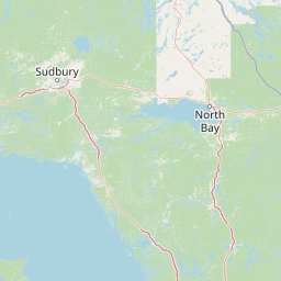
| Pembroke to North Bay | 217 km |
| Pembroke to London 2 | 569 km |
| Pembroke to Cornwall | 248 km |
Related Distances to Guelph
| Cities | Distance |
|---|---|
| Toronto to Guelph | 90 km |
| Hamilton to Guelph | 54 km |
| Kitchener to Guelph | 32 km |
| London 2 to Guelph | 119 km |
| Mississauga to Guelph | 71 km |