Distance from Perez to Vera
Distance between Perez and Vera is 397 kilometers (247 miles).
Driving distance from Perez to Vera is 431 kilometers (268 miles).
Distance Map Between Perez and Vera
Perez, Santa Fe de la Vera Cruz, Argentina ↔ Vera, Santa Fe de la Vera Cruz, Argentina = 247 miles = 397 km.


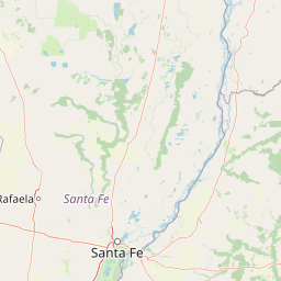


How far is it between Pérez and Vera
Perez is located in Argentina with (-32.9984,-60.7679) coordinates and Vera is located in Argentina with (-29.4593,-60.2126) coordinates. The calculated flying distance from Perez to Vera is equal to 247 miles which is equal to 397 km.
If you want to go by car, the driving distance between Perez and Vera is 430.88 km. If you ride your car with an average speed of 112 kilometers/hour (70 miles/h), travel time will be 03 hours 50 minutes. Please check the avg. speed travel time table on the right for various options.
Difference between fly and go by a car is 34 km.
| City/Place | Latitude and Longitude | GPS Coordinates |
|---|---|---|
| Perez | -32.9984, -60.7679 | 32° 59´ 54.0600'' S 60° 46´ 4.4760'' W |
| Vera | -29.4593, -60.2126 | 29° 27´ 33.4800'' S 60° 12´ 45.3960'' W |
Estimated Travel Time Between Pérez and Vera
| Average Speed | Travel Time |
|---|---|
| 30 mph (48 km/h) | 08 hours 58 minutes |
| 40 mph (64 km/h) | 06 hours 43 minutes |
| 50 mph (80 km/h) | 05 hours 23 minutes |
| 60 mph (97 km/h) | 04 hours 26 minutes |
| 70 mph (112 km/h) | 03 hours 50 minutes |
| 75 mph (120 km/h) | 03 hours 35 minutes |
Related Distances from Perez
| Cities | Distance |
|---|---|
| Perez to Rosario | 26 km |
| Perez to Villa Ocampo | 580 km |
| Perez to San Jorge | 202 km |
| Perez to Rafaela | 250 km |
| Perez to Vera | 431 km |
Related Distances to Vera
| Cities | Distance |
|---|---|
| San Javier 3 to Vera | 161 km |
| Canada De Gomez to Vera | 459 km |
| Capitan Bermudez to Vera | 409 km |
| Reconquista to Vera | 68 km |
| Perez to Vera | 431 km |