Distance from Perrysburg to Marion
Distance between Perrysburg and Marion is 115 kilometers (72 miles).
Driving distance from Perrysburg to Marion is 146 kilometers (91 miles).
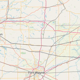
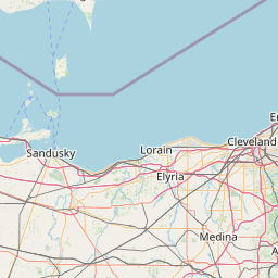
Distance Map Between Perrysburg and Marion
Perrysburg, Columbus, United States ↔ Marion, Columbus, United States = 72 miles = 115 km.


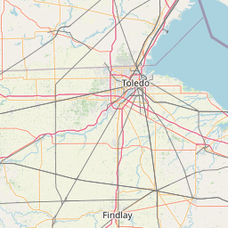


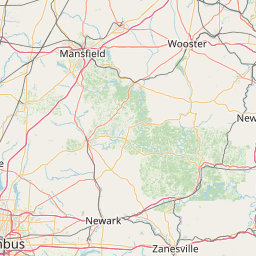


How far is it between Perrysburg and Marion
Perrysburg is located in United States with (41.557,-83.6272) coordinates and Marion is located in United States with (40.5887,-83.1285) coordinates. The calculated flying distance from Perrysburg to Marion is equal to 72 miles which is equal to 115 km.
If you want to go by car, the driving distance between Perrysburg and Marion is 145.65 km. If you ride your car with an average speed of 112 kilometers/hour (70 miles/h), travel time will be 01 hours 18 minutes. Please check the avg. speed travel time table on the right for various options.
Difference between fly and go by a car is 31 km.
| City/Place | Latitude and Longitude | GPS Coordinates |
|---|---|---|
| Perrysburg | 41.557, -83.6272 | 41° 33´ 25.2000'' N 83° 37´ 37.7760'' W |
| Marion | 40.5887, -83.1285 | 40° 35´ 19.2120'' N 83° 7´ 42.6720'' W |
Estimated Travel Time Between Perrysburg and Marion
| Average Speed | Travel Time |
|---|---|
| 30 mph (48 km/h) | 03 hours 02 minutes |
| 40 mph (64 km/h) | 02 hours 16 minutes |
| 50 mph (80 km/h) | 01 hours 49 minutes |
| 60 mph (97 km/h) | 01 hours 30 minutes |
| 70 mph (112 km/h) | 01 hours 18 minutes |
| 75 mph (120 km/h) | 01 hours 12 minutes |
Related Distances from Perrysburg
| Cities | Distance |
|---|---|
| Perrysburg to Bowling Green 2 | 21 km |
| Perrysburg to Lima 2 | 113 km |
| Perrysburg to Cincinnati | 305 km |
| Perrysburg to Mason | 281 km |
| Perrysburg to Cleveland | 179 km |
Related Distances to Marion
| Cities | Distance |
|---|---|
| Muncie to Marion 3 | 62 km |
| Westfield 3 to Marion 3 | 91 km |
| South Bend to Marion 3 | 168 km |
| West Lafayette to Marion 3 | 118 km |
| Noblesville to Marion 3 | 70 km |