Distance from Phaltan to Wai
Distance between Phaltan and Wai is 57 kilometers (36 miles).
Driving distance from Phaltan to Wai is 67 kilometers (42 miles).
Distance Map Between Phaltan and Wai
Phaltan, Mumbai, India ↔ Wai, Mumbai, India = 36 miles = 57 km.


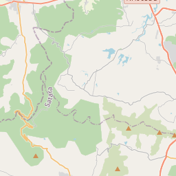

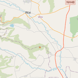

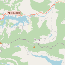

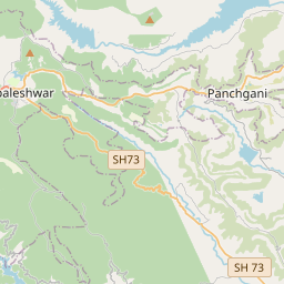


Leaflet | © OpenStreetMap
How far is it between Phaltan and Wai
Phaltan is located in India with (17.9911,74.4318) coordinates and Wai is located in India with (17.9528,73.8906) coordinates. The calculated flying distance from Phaltan to Wai is equal to 36 miles which is equal to 57 km.
If you want to go by car, the driving distance between Phaltan and Wai is 67.16 km. If you ride your car with an average speed of 112 kilometers/hour (70 miles/h), travel time will be 00 hours 35 minutes. Please check the avg. speed travel time table on the right for various options.
Difference between fly and go by a car is 10 km.
| City/Place | Latitude and Longitude | GPS Coordinates |
|---|---|---|
| Phaltan | 17.9911, 74.4318 | 17° 59´ 28.0680'' N 74° 25´ 54.3720'' E |
| Wai | 17.9528, 73.8906 | 17° 57´ 9.9360'' N 73° 53´ 26.0880'' E |
Estimated Travel Time Between Phaltan and Wai
| Average Speed | Travel Time |
|---|---|
| 30 mph (48 km/h) | 01 hours 23 minutes |
| 40 mph (64 km/h) | 01 hours 02 minutes |
| 50 mph (80 km/h) | 00 hours 50 minutes |
| 60 mph (97 km/h) | 00 hours 41 minutes |
| 70 mph (112 km/h) | 00 hours 35 minutes |
| 75 mph (120 km/h) | 00 hours 33 minutes |
Phaltan, Mumbai, India
Related Distances from Phaltan
| Cities | Distance |
|---|---|
| Phaltan to Sangola | 120 km |
| Phaltan to Tuljapur | 217 km |
| Phaltan to Satara | 65 km |
| Phaltan to Pune | 112 km |
| Phaltan to Shegaon | 478 km |
Wai, Mumbai, India
Related Distances to Wai
| Cities | Distance |
|---|---|
| Satara to Wai | 34 km |
| Pune to Wai | 87 km |
| Panvel to Wai | 199 km |
| Karad to Wai | 87 km |
| Phaltan to Wai | 67 km |