Distance from Pingyin to Weihai
Distance between Pingyin and Weihai is 522 kilometers (324 miles).
Driving distance from Pingyin to Weihai is 599 kilometers (372 miles).
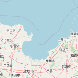
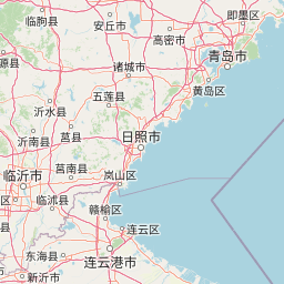
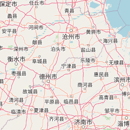
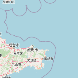
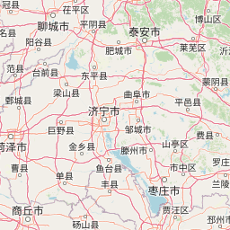
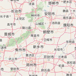
Distance Map Between Pingyin and Weihai
Pingyin, Jinan, China ↔ Weihai, Jinan, China = 324 miles = 522 km.

How far is it between Pingyin and Weihai
Pingyin is located in China with (36.2831,116.4453) coordinates and Weihai is located in China with (37.5091,122.1136) coordinates. The calculated flying distance from Pingyin to Weihai is equal to 324 miles which is equal to 522 km.
If you want to go by car, the driving distance between Pingyin and Weihai is 599.38 km. If you ride your car with an average speed of 112 kilometers/hour (70 miles/h), travel time will be 05 hours 21 minutes. Please check the avg. speed travel time table on the right for various options.
Difference between fly and go by a car is 77 km.
| City/Place | Latitude and Longitude | GPS Coordinates |
|---|---|---|
| Pingyin | 36.2831, 116.4453 | 36° 16´ 59.0160'' N 116° 26´ 43.0080'' E |
| Weihai | 37.5091, 122.1136 | 37° 30´ 32.9040'' N 122° 6´ 48.8160'' E |
Estimated Travel Time Between Pingyin and Weihai
| Average Speed | Travel Time |
|---|---|
| 30 mph (48 km/h) | 12 hours 29 minutes |
| 40 mph (64 km/h) | 09 hours 21 minutes |
| 50 mph (80 km/h) | 07 hours 29 minutes |
| 60 mph (97 km/h) | 06 hours 10 minutes |
| 70 mph (112 km/h) | 05 hours 21 minutes |
| 75 mph (120 km/h) | 04 hours 59 minutes |
Related Distances from Pingyin
| Cities | Distance |
|---|---|
| Pingyin to Weifang | 283 km |
| Pingyin to Xiazhuang | 359 km |
| Pingyin to Xiazhen | 243 km |
| Pingyin to Tai An | 115 km |
| Pingyin to Sishui | 178 km |
Related Distances to Weihai
| Cities | Distance |
|---|---|
| Qingdao to Weihai | 277 km |
| Tengzhou to Weihai | 678 km |
| Linyi to Weihai | 530 km |
| Rizhao to Weihai | 389 km |
| Weifang to Weihai | 321 km |